(Part 2) Top products from r/Maps
We found 22 product mentions on r/Maps. We ranked the 40 resulting products by number of redditors who mentioned them. Here are the products ranked 21-40. You can also go back to the previous section.
21. The Measure of All Things: The Seven-Year Odyssey and Hidden Error That Transformed the World
Sentiment score: 1
Number of reviews: 1
Used Book in Good Condition
 Show Reddit reviews
22. Collins World Atlas: Mini Edition
Sentiment score: 1
Number of reviews: 1
HarperCollins UK
 Show Reddit reviews
23. 2018 Collins Europe Essential Road Atlas
Sentiment score: 0
Number of reviews: 1
 Show Reddit reviews
24. A Thread Across the Ocean: The Heroic Story of the Transatlantic Cable
Sentiment score: 1
Number of reviews: 1
 Show Reddit reviews
25. The Map That Changed the World: William Smith and the Birth of Modern Geology
Sentiment score: 1
Number of reviews: 1
Harper Perennial
 Show Reddit reviews
26. Mastering ArcGIS with Video Clips DVD-ROM
Sentiment score: 1
Number of reviews: 1
 Show Reddit reviews
27. Transit Maps of the World: The World's First Collection of Every Urban Train Map on Earth
Sentiment score: 1
Number of reviews: 1
 Show Reddit reviews
28. Classic Edition World Wall Map Paper Rolled
Sentiment score: 1
Number of reviews: 1
 Show Reddit reviews
29. Rand McNally 2016 Road Atlas (Rand McNally Road Atlas)
Sentiment score: 0
Number of reviews: 1
350 cities20 U.S. national parksRoad construction projects and updates highlightedmileage chart showing distances between 90 North American cities and national parksTourism websites and phone numbers
 Show Reddit reviews
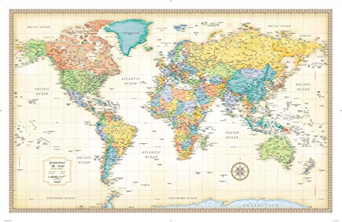
30. Rand Mcnally World Map (Classic Edition World Wall Map)
Sentiment score: 1
Number of reviews: 1
Top Rand McNally Quality World MapCurrent World Map featuring Antique TonesPaper Edition World MapShips rolled in a sturdy shipping tubeLarge World Wall Map
 Show Reddit reviews
31. Collins World Atlas: Mini Edition: Handy Reference Atlas for Exploring the Whole World
Sentiment score: 1
Number of reviews: 1
Used Book in Good Condition
 Show Reddit reviews
32. 2019 Road Atlas Europe 2019 (AA Road Atlas Europe)
Sentiment score: 0
Number of reviews: 1
 Show Reddit reviews
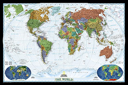
33. National Geographic: World Decorator Wall Map - Laminated (46 x 30.5 inches) (National Geographic Reference Map)
Sentiment score: 0
Number of reviews: 1
Top quality National Geographic Map30x43 Poster SizeDurable 3mil LaminationAlso available Wood Framed from Swiftmaps
 Show Reddit reviews
34. Longitude: The True Story of a Lone Genius Who Solved the Greatest Scientific Problem of His Time
Sentiment score: 1
Number of reviews: 1
 Show Reddit reviews
35. Washington Atlas & Gazetteer (Delorme Atlas & Gazetteer)
Sentiment score: 0
Number of reviews: 1
The atlas & gazetteer is ideal for outdoor recreation, business travel, home or office reference, and countless other usesYou will also find a wealth of information on everything from family outings to wilderness adventuresDelorme has been directly responsible for many of the major technological adv...
 Show Reddit reviews
36. Unique Media Map: United States/Folded
Sentiment score: 1
Number of reviews: 1
Used Book in Good Condition
 Show Reddit reviews
37. Mapping Time: Illustrated by Minard's Map of Napoleon's Russian Campaign of 1812
Sentiment score: 1
Number of reviews: 1
 Show Reddit reviews
38. Cartographies of Time: A History of the Timeline
Sentiment score: 1
Number of reviews: 1
Princeton Architectural Press
 Show Reddit reviews
39. Cavallini Decorative Wrap Poster, Celestial Chart, 20 x 28 inch Italian Archival Paper (WRAP/Celest)
Sentiment score: 1
Number of reviews: 1
Decorative wall poster for your home or officeEasy to frame and makes a great novelty giftPoster measures 20 x 28 inchesVintage inspired celestial charts of the northern & southern hemispherePrinted on Italian archival paper
 Show Reddit reviews
Also, I used Mastering ArcGIS by Maribeth Price in my class. She does a really good job getting you started with ArcGIS. Even if it's a lot more "click this, then this, then this, then this" you still somehow get to know what you're actually doing pretty quickly. GIS really is a fun hobby if you have an interest in maps. There are SO many possibilities.
The best pocket atlas I've ever come across is by Collins. I don't particularly like their large reference atlases but their smaller pocket ones are really quite lovely.
Patience, precise record-keeping, good old trigonometry, a whole lot of hiking, repeat all of the above hundreds upon hundreds of times in all weather and against all odds.
For specifics on how things were done around this time, read "The measure of all things", that should answer most of your questions. I believe there was a TV show about it (or was it "Longitude"?)
If you are interested in older methods, youtube is your friend
https://www.youtube.com/watch?v=26y-li-lOSI
TL,DW: Largely, the same methods applied
Hi there, I have this map on my wall and I love it. It has South Sudan and pretty sturdy paper (it's not plastic by any means, though.) It's quite large, about a meter lengthwise.
I always used to like Bartholomew's but looks like they long ago merged with Collins. Looks like Collins still do a mini-sized atlas.
That was a cool slideshow. Did anyone see the pictures of the Swedish subway system that were on Reddit a month or two ago? Also, has anyone else checked this book out? I snagged a cheap used copy. It definitely focuses on the design aspect of the map, rather than tons of info about the subway, but it'll make any transit geek happy.
I have a world map that I bought at Walmart wayyy back. Looks great. Has all the large and fair sized cities on it and an old fashioned "weathered" colour to it. Very closely related to this one.
Amazon has 'em. I'm pretty sure I've also seen them at Metsker Maps in downtown Seattle.
https://smile.amazon.com/Unique-Media-Map-United-States/dp/0921338503/ref=sr_1_2?keywords=unique+media+maps&qid=1563467376&s=gateway&sr=8-2
Cavallini & Co. Celestial Chart Poster Wrapping Paper Sheet https://www.amazon.com/dp/1619926660/ref=cm_sw_r_cp_apa_i_iVKxCbZ4Q80K2
Pretty sure it's this one. I own it, too. Says wrapping paper sheet but it works like a light, textured poster
Maybe something like this
https://www.amazon.de/gp/aw/d/B013P0X02G/ref=mp_s_a_1_3?ie=UTF8&qid=1481567533&sr=8-3&pi=SY200_QL40&keywords=cartography&dpPl=1&dpID=51A1vdzIDIL
Or even better :
https://www.amazon.de/gp/aw/d/1616890584/ref=mp_s_a_1_2?ie=UTF8&qid=1481567533&sr=8-2&pi=SY200_QL40&keywords=cartography&dpPl=1&dpID=51NXS6lf8RL
Also worth reading if you're interested in more history of cable laying: [A Thread Across the Ocean] (http://www.amazon.com/gp/aw/d/0060524464).
terrific book, by the way
Map That Changed The World!
https://www.amazon.com/Washington-Atlas-Gazetteer-Delorme/dp/089933329X
Something like this maybe? These aren't very portable tho.
I'd go for any map from National Geographic. I have this one: https://www.amazon.com/gp/aw/d/0792283090/ref=mp_s_a_1_2?ie=UTF8&qid=1466813745&sr=8-2&pi=SX200_QL40&keywords=national+geographic+world+map&dpPl=1&dpID=61p5k71NQ-L&ref=plSrch
Highly recommended. Has enough information that you can see something new every time you look at it.
How much detail do you need? I find a Michelin title no. 970 ("Europe," 1:3 million) is plenty detailed for itinerary planning. I use a Thomas Cook or East View rail map for planning train trips. For driving, I find an atlas more convenient, covering most of Europe at the same scale. The German auto club ADAC published a nice one, but so do Collins or AA (1:900,000 with English legends) or Michelin, or Marco Polo.
Here you go, both these pages have images which you can zoom in on to get a sense of the detail.
https://www.amazon.com/Rand-McNally-2016-Road-Atlas/dp/0528013130
https://www.aerostich.com/michelin-north-america-road-atlas.html
http://www.amazon.co.uk/gp/offer-listing/1869847024/ref=tmm_other_meta_binding_new_olp_sr?ie=UTF8&condition=new&qid=1449615858&sr=8-2
Meh?