Top products from r/mapmaking
We found 29 product mentions on r/mapmaking. We ranked the 31 resulting products by number of redditors who mentioned them. Here are the top 20.
1. How to Draw Fantasy Art and RPG Maps: Step by Step Cartography for Gamers and Fans
Sentiment score: 2
Number of reviews: 3
How to Draw Fantasy Art and RPG Maps Step by Step Cartography for Gamers and Fans
 Show Reddit reviews
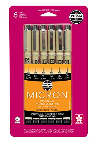
2. Sakura Pigma 30062 Micron Blister Card Ink Pen Set, Black, Ass't Point Sizes 6CT Set
Sentiment score: 2
Number of reviews: 3
Experience smooth, skip-free writing in crisp, rich black ink to achieve consistent lettering and lines widths.Professional inking pens used by comic artists, illustrators, watercolor artists, archivists, and laboratory professionals.Pigma ink is archival quality on paper: waterproof, chemical resis...
 Show Reddit reviews
3. Push Pin Travel Maps Earth Toned World with Black Frame and Pins - 27.5 inches x 39.5 inches
Sentiment score: 1
Number of reviews: 2
Track your world travels on this beautiful Push Pin Travel MapGreat conversation starterReady to hang on your wallElegant 2 inch black frame 39.5 Inches Wide x 27.5 Inches HighIncludes 100 pins in a mixture of Red, White and Black
 Show Reddit reviews
4. Academia Maps World Wall Map - Global Topography & Bathymetry w/Labels and Borders - 48" x 24"
Sentiment score: 1
Number of reviews: 2
Map is fully laminated using high quality 3 mil hot lamination, front and back.Eyelets are added to the map providing reinforced hanging points for pushpins.The maps surface can be written on with a dry or wet erase marker.
 Show Reddit reviews
5. The Ravens of Carrid Tower (Gods of Empire Book 1)
Sentiment score: -2
Number of reviews: 1
 Show Reddit reviews
6. The Dictionary of Imaginary Places: The Newly Updated and Expanded Classic
Sentiment score: 0
Number of reviews: 1
Harcourt
 Show Reddit reviews
7. GREAT ART Large Photo Wallpaper – Retro World Map Used Look – Picture Decoration Globe Continents Atlas Earth Retro Old School Vintage Image Decor Wall Mural (132.3x93.7in - 336x238cm)
Sentiment score: 0
Number of reviews: 1
Size: 132.3 Inch x 93.7 Inch / 336 x 238 cm - 8 pieces. The Old Fashion world map gives your home a chic and modern look. Its sephia colors gives a vintage and interesting look to the poster, assuring to be a piece of art on your wall.The old school map gives every room the ultimate retro charm. Wor...
 Show Reddit reviews
8. Harbin Geological Compass DQL-8
Sentiment score: 1
Number of reviews: 1
Global Use DQL-8 : https://www.facebook.com/GeologyGift/videos/1263187693777625/
 Show Reddit reviews
9. World. Mercator's Projection. Ocean Currents & Shipping Routes. BLACKIE - 1882 - Old map - Antique map - Vintage map - Printed maps of World
Sentiment score: 1
Number of reviews: 1
Title: 'The World on Mercators projection showing the courses of the chief ocean currents and the navigation tracks between the principal ports'Condition: Good; suitable for framing. However, please note: The image shown may have been taken from a different example of this map than that which is off...
 Show Reddit reviews
10. Point 88 Fineliner Pens 0.4m 30 color wallet set
Sentiment score: 1
Number of reviews: 1
COMFORTABLE GRIP - The famous hexagonal body shape of the STABILO point 88 makes it very comfortable to grip.METAL ENCLOSED TIP - The 0.4mm line width offers you a great deal of control and precision and the metal-enclosed tip provides strength and durability.PRECISE - For drawing you can create int...
 Show Reddit reviews
11. Faber Castell FC167137 Wallet Pitt Pen Nibs Art Set, Assorted
Sentiment score: 1
Number of reviews: 1
PITT artist pens contain pigmented India ink that is both archival and acid freePerfect for drawing on the go!Convenient wallet keeps all your drawing tools togetherPigmented India ink that is both acid free and pH NeutralSmudge proof and waterproof when dry
 Show Reddit reviews
12. Prismacolor 1738862 Premier Illustration Markers, Assorted Tips, Black, 7-Count
Sentiment score: 1
Number of reviews: 1
Fine, chisel and brush tips ensure you can make precisely the right markRichly pigmented ink is acid free, lightfast, permanent, water resistant, smear resistant when dry and doesn’t bleed through paperFine tips create crisp details, chisel tip provides broad coverage and a flexible brush tip for ...
 Show Reddit reviews
13. Pentel Graph Gear 1000 Drafting Pencil 0.5mm
Sentiment score: 1
Number of reviews: 1
Automatic Drafting Pencil, .5mm, Gray Accent Barrel
 Show Reddit reviews
14. Making Maps, Second Edition: A Visual Guide to Map Design for GIS
Sentiment score: 0
Number of reviews: 1
Used Book in Good Condition
 Show Reddit reviews
16. Schemers and Dreamers: Filibustering in Mexico, 1848-1921
Sentiment score: 1
Number of reviews: 1
 Show Reddit reviews
17. Book of Challenges: Dungeon Rooms, Puzzles, and Traps (Dungeons & Dragons d20 3.0 Fantasy Roleplaying)
Sentiment score: 1
Number of reviews: 1
Used Book in Good Condition
 Show Reddit reviews

If you look closely you can see the shapes of individual buildings, which can be discovered via satellite imagery. Then you have street names and place
names, not terribly difficult to obtain when you have diplomatic staff in the city. There is also hydrographic information about the Potomac such as
depths, flow rate, and width, which was often taken from the official surveys (to say nothing of having a soviet branded survey vessel taking readings
outside the Pentagon's windows). Less obvious from the picture is that they have ascertained the building material, weight limit, and clearance of the
bridges, which could only have been done by boots on the ground.
Here's a larger sample taken from the same scale. Look how much detail went into that. Borrowed from here.
Now picture that all of this information was mapped by the Soviets of nearly the entire world's urban areas- over 2,000, though many have not resurfaced-
and you get a good idea of the wealth of information that they had to work with. In some of the Warsaw Pact countries they had crazy details like
individual trees and the distance between them listed.
These maps are fascinating and a little unsettling. They have a lot of details left out of official published maps, like military installations, the names and products of factories,
mountain passes and what time of the year they were passable, police stations, even subway line stops and if the lines were electric or not. What does that mean? The maps could be
used for conventional air strikes bombardments, and troop movements, but that doesn't account for the civilian infrastructure like mass transit- they must have been occupation maps as
well. They knew which bridges their tanks could cross, which rivers their ships could navigate, where the vast majority of our military and government buildings were, the various heights
of neighborhoods to help troops unfamiliar with the area... And not just the US, either. Most countries. On top of that, the maps were regularly updated. Think of the resources needed
to handle all of that.
While no one is sure just how many maps there are and of what areas, a lot surfaced in the Baltics following the collapse of the Soviet Union.
This article from Wired is a fascinating read. You can now buy originals and reproductions from ebay shops based in Latvia and
Lithuania as well as vendors who likely purchased from those guys. Here is a large scale map of my hometown of Dallas, TX. Incidentally, if anyone
can find a copy of the 1:25,000 map that supposedly exists I'd love to see it. It would look very cool on my wall. It's unnerving and beautiful all at once.
Further reading: Red Atlas: How the Soviet Union Secretly Mapped the World
This book was recently released and I finished it yesterday. It's more of a technical analysis, there still isn't really any information about the how and the official why.
I thought it was fascinating. It goes into the detail, the errors made, the cultural assumptions made that didn't translate well, etc. You can tell a lot about a country by
how they draw and label yours.
Thanks for reading! Would love to see any additional info on this in the replies. I'm so amazed that these maps exist.
> Goblins
Actually, I think they'd be more likely to strike as soon as the party makes themselves comfortable - as in, they settle down for the night - after clearing a large infestation.
> Recruiting soldiers at different cities
And, IIRC, pay for a trained soldier is between 1 silver and 1 gold coin (1 gp = 10 sp)... at least in 3.5.
----------------
No idea what edition are you playing, but Stronghold Builder's Guide has plenty of material not restricted by editions. Book of Challenges also has a pile on info for making in-built castle and dungeon protection mechanisms (read: traps).
Finally, take a look at Stirling Castle, Scotland. I came across it fairly recently, been drooling ever since. It looks amazing. Only needs some adjustments for a fantasy setting - for example, protection against flying enemies.
Happy DMing! :)
If you are starting with photoshop, I suggest you first get a basic understanding of how the program itself works. What I did was just to look up tutorials on youtube (There are thousands) and just follow along. In the start you don't really need to know what you are doing, just to get comfortable with the buttons and shortcuts.
Then I'd suggest learning about layers, since it's very important to know how they interact with eachother. Following that, try a map-making tutorial (which you can also find on youtube there are also several on cartographers guild, and after you finish it, try to recreate it from memory and see how it goes. Be prepared to put in a lot of time however, my first map took me some 50-60 hours to make. However I was learning as I was going along, seeing what works, and what does not work.
If you decide to try to do it by hand, all I can say is that practice makes perfect. I have a friend who bought ( http://www.amazon.com/How-Draw-Fantasy-Art-Maps/dp/1440340242#reader_1440340242) and managed to bang out incredible looking maps, and he's not at all a naturally talented artist.
Small but nice, probably way overpriced though.
https://www.amazon.com/dp/B00MOOEDXU/ref=cm_sw_r_cp_apa_2PN5xb74G1HJ9
Bigger with some names, wouldn't call it a political map.
https://www.amazon.com/gp/aw/d/B01D53G5TS/ref=pd_aw_sim_sbs_201_3?ie=UTF8&psc=1&refRID=09W2NDA68NWMRZYEM9MZ
I think this is some kind of special sticker but you could just remove the quotes.
https://www.amazon.com/dp/B01B7VPIZC/ref=cm_sw_r_cp_apa_lUN5xb540YKHD
Similar to the last without the quotes and is solid black.
https://www.amazon.com/dp/B013F1CY7M/ref=cm_sw_r_cp_apa_6VN5xb9C38JQM
This one is pretty cool and it's cloth.
https://www.amazon.com/dp/B01LNFTUPG/ref=cm_sw_r_cp_apa_VXN5xbVTBS8EE
I'm a geologist and a lot of the mapping I did in school was mapping rock units and geologic features on topographic maps with mylar overlays. Super fun. Might work well for you.
Map Board: http://www.cattywampur.com/2016/04/09/custom-high-quality-map-board/
Overkill Compass: https://www.amazon.com/gp/aw/d/B00I4W95CK/ref=pd_aw_sim_sbs_468_1?ie=UTF8&psc=1&refRID=NGJQ452XT4PM017FHJB3&dpPl=1&dpID=61-8qtWso8L
Topo Maps: https://ngmdb.usgs.gov/topoview/viewer/
Yeah; don't mess up!
I'm just kidding, I do have an actual tip. Since I don't know your experience level, it might be stuff you know already, sorry if so.
Use pens with different size tips (such as these ) to differentiate different elements, like the outline of the mountains vs the contours of the mountains, and the coastline vs rivers. Start by inking everything but the thinnest lines with a medium size pen, then go over the thicker lines with the thicker pen. This gives you some wiggle room for changing shapes slightly during the inking process, so you're not stuck with the first line you laid down. Then when all of that is done, give it about 10-20 minutes to fully dry and erase your pencil lines gently with a white eraser.
Then go in with your thinnest pen and do the finest lines.
Oh OK, I like the idea of canals, that's actually really cool. Ummm, colored pencils would look really nice, but might smudge. I usually go with a set of Stabilo art markers. Either way, get something with a large range, so you can shade a lot.
This is what I use personally, although you should maybe buy a single pen or pencil to see how you like them before shelling out for anything big. Most art shops sell singles.
https://www.amazon.com/Stabilo-8830-1-Point-30-Coloring-Fineline/dp/B00ATBRJRC
That's a pretty neat coincidence. You should read a book called Schemers and Dreamers: Filibustering in Mexico, 1848-1921, which discusses in detail various abortive attempts to carve new American-ruled republics out of northern Mexico. Filibustering in general would be worth studying if you want to do a really deep dive. William Walker, who conquered Nicaragua and ruled it for two years, might be especially interesting. There are several modern books out about him, but I haven't read any of them so I can't offer any recommendations.
Coming along nicely. I recommend skipping the sharpies and getting s few of these instead:
Sakura 30062 6-Piece Pigma Micron Ink Pen Set, Black https://www.amazon.com/dp/B0008G8G8Y/ref=cm_sw_r_cp_api_tdoFzbDR665K5
Check out Fantasy Art & RPG Maps Book, page 68. Author recommends strong horizontal line with several vertical lines going upwards (see andrea55TP's reply). Then lightly draw in angled/curvy horizontal lines to represent the mushy stuff.
Here's a world map with accurate topography and very low-key borders.
Here's a quite nice watercolor map.
Here's a reproduction of an antique map of ocean currents and shipping routes.
Here's a map of famous flight paths around the world.
I recommend these instead of Sharpies...
https://www.amazon.com/Prismacolor-Premier-Illustration-Markers-Assorted/dp/B0026HZ4BK/ref=sr_1_1?s=arts-crafts&ie=UTF8&qid=1501484025&sr=1
You can sometimes find the 4 pen package at walmart.
If you do go with Sharpie, they now make a pen that has less bleed than the regular precision tip markers, but they still bleed more than the prismacolors.
You should check on local art stores, they have all sorts of cool stuff that you can often try out before purchasing.
I actually never draw details with pencil, I add everything directly with ink. I use the pencil only to roughly sketch the layout of the map, then most of the details I put on the fly.
So you can use whatever pencil you prefer, but if you are curious which pencil I use, it's this one: https://www.amazon.co.uk/gp/product/B001E3GUBK
I do not mind at all, Good Sir... I prefer using the absolute FINEST of the cheapest of pens I found on Amazon.
I'm using [Pigma Micron] (http://www.amazon.com/Sakura-30062-6-Piece-Pigma-Micron/dp/B0008G8G8Y/ref=sr_1_1?ie=UTF8&qid=1453233047&sr=8-1&keywords=pigma+micron+archival+ink) pens right now and I really like them.
Well, I found it after a bit of hunting.
City Works by mike mearls, a legends and lairs supplement for D&D third edition.
https://www.amazon.com/Legends-Lairs-Works-Mike-Mearls/dp/1589940970
The city building chapter it had was what I was trying to recall.
you could consider this book from 2000 (you can peek inside on Amz): https://www.amazon.com/Dictionary-Imaginary-Places-Updated-Expanded/dp/0156008726/ref=sr_1_1?ie=UTF8&qid=1484468189&sr=8-1&keywords=imaginary+places
If you haven't already found it yourself, I tried googling the names in the picture and I think it's Making Maps, Second Edition: A Visual Guide to Map Design for GIS.
I don't know if there is any pdf form, but i bought it here: https://www.amazon.com.br/How-Draw-Fantasy-Art-Maps/dp/1440340242
Here is the mobile version of your link
This is Lathania. A world of machiavellian gods, corrupt rulers and reluctant heroes.
The hegemony of Carrid is coming to an end and powerful forces are schemeing to tip the continent back into total war.
I started the project trying to map todays real world geo politics into a fantasy form, but the manuscript took a life of its own and "The Ravens of Carrid Tower" was born.
Carrid Tower holds a million souls within its walls and is the dominant civilisation in Lathania.
The Quoroubi desert has been taken over by a cannibal death cult.
The Empire of Narubez seeks to overthrow the peace of Carrid.
A queen is crowned in Drorea.
Pirates terrorize the coast.
A boy travels alone to seek his fortune in Talon.
War is coming. Kingdoms will fall. Heroes will be made.
---
The book is free on Kindle for the next 4 days if anyone wants a copy.
https://www.amazon.com/Ravens-Carrid-Tower-Gods-Empire-ebook/dp/B07HQGX42W/
The book Proxima by Stephen Baxter involves a tidally locked world, and he goes into to some of the climate and biology.
I can't actually recommend the book for the story: A few clever ideas, decent execution, but mostly horrible characters, several strange and unneeded plot twists, and let's not forget the surprise cannibalism and Romans Legionnaires!
tldr; Skim it for the world building, skip the actual story.