(Part 2) Top products from r/roadtrip
We found 21 product mentions on r/roadtrip. We ranked the 77 resulting products by number of redditors who mentioned them. Here are the products ranked 21-40. You can also go back to the previous section.
21. Sistema KLIP IT Utility Collection Cereal Container, 17.75 Cup, Clear/Blue | BPA Free
Sentiment score: 1
Number of reviews: 1
Cereal food storage container helps keep your cereal fresh and your pantry organizedLid with easy-locking clips and extended flexible seal helps keep contents freshFlip-top lid allows for convenient pouringSculptured grips for comfortable handling and pouringCereal storage container holds 94.0 ounce...
 Show Reddit reviews
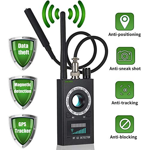
22. High Sensitivity Spy Detector & Magnetic Signal Scanning Hidden Camera Lens Detection RF Signal Detector Wireless Signal Bug Detector for GSM Listening&Tracking Device Finder
Sentiment score: 1
Number of reviews: 1
★ 『Portable Anti Spy detector』This improved hidden camera detector have follow characteristic:Stronger anti-jamming, wider range of detection frequency. Higher Sensitivity. It can detect 1.2G to 5.8G wireless hidden camera wifi camera , pinhole camera, spy camera, ip camera ,monitor, surveilla...
 Show Reddit reviews
23. Route 66: EZ66 GUIDE For Travelers - 3RD EDITION
Sentiment score: 0
Number of reviews: 1
 Show Reddit reviews
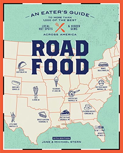
24. Roadfood, 10th Edition: An Eater's Guide to More Than 1,000 of the Best Local Hot Spots and Hidden Gems Across America (Roadfood: The Coast-To-Coast Guide to the Best Barbecue Join)
Sentiment score: 1
Number of reviews: 1
Clarkson Potter
 Show Reddit reviews
25. Large Scale Road Atlas (Rand Mcnally Large Scale Road Atlas USA)
Sentiment score: 1
Number of reviews: 1
6 Great Drives Special road trips hand picked by our editorsRead about the winning teams and small towns from the 3nd annual Best of the Road contest.Use this book with the Rand McNally Road Atlas Ebook. Learn more at randmcnally.com/mobileTourism websites and phone numbers for every U.S. state and ...
 Show Reddit reviews
27. 2019 Rand McNally Road Atlas
Sentiment score: 0
Number of reviews: 1
Sold as 1 Each.Contains maps of every U.S. state, plus over 300 detailed city insets.Includes national parks maps.Contains mileage chart showing distances between over 70 cities and national parks with driving times calculated.National Parks Guide highlights essential visitor information and offers ...
 Show Reddit reviews
28. Rand McNally 2020 National Park Atlas & Guide
Sentiment score: 1
Number of reviews: 1
 Show Reddit reviews
29. Crossing America: National Geographic's Guide to the Interstates
Sentiment score: 0
Number of reviews: 1
Used Book in Good Condition
 Show Reddit reviews
30. Southern Food: At Home, on the Road, in History (Chapel Hill Books)
Sentiment score: 1
Number of reviews: 1
Used Book in Good Condition
 Show Reddit reviews
31. The Great American Road Trip: U.S. 1, Maine to Florida
Sentiment score: 1
Number of reviews: 1
Used Book in Good Condition
 Show Reddit reviews
32. Utah Atlas & Gazetteer (6th Edition)
Sentiment score: 0
Number of reviews: 1
Includes Back roads, elevation contours, recreational areas, etc.Paperback for easy carry and storageEasy to use and read
 Show Reddit reviews
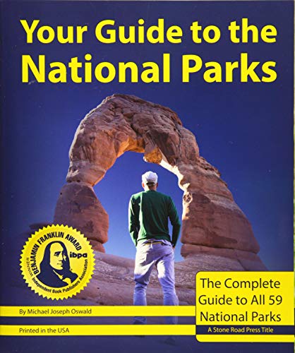
33. Your Guide to the National Parks: The Complete Guide to all 59 National Parks (Second edition)
Sentiment score: 2
Number of reviews: 1
Stone Road Press
 Show Reddit reviews
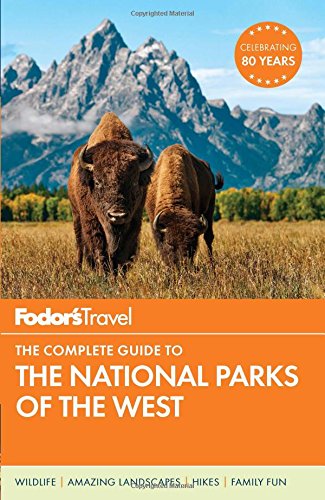
34. Fodor's The Complete Guide to the National Parks of the West (Full-color Travel Guide)
Sentiment score: 1
Number of reviews: 1
PUBLISHERS GROUP UK
 Show Reddit reviews
35. National Geographic Secrets of the National Parks: The Experts' Guide to the Best Experiences Beyond the Tourist Trail (National Geographics Secrets of the National Parks)
Sentiment score: 1
Number of reviews: 1
Ngeo Secrets Of National Parks
 Show Reddit reviews
36. Great American Eating Experiences: Local Specialties, Favorite Restaurants, Food Festivals, Diners, Roadside Stands, and More
Sentiment score: 1
Number of reviews: 1
National Geographic
 Show Reddit reviews
37. Traveler's Cookbook: Auto, RV, and Semi Meals Made Easy
Sentiment score: 0
Number of reviews: 1
 Show Reddit reviews
![Four Corners [Trail of the Ancients] (National Geographic Destination Map)](https://m.media-amazon.com/images/I/51zgrm+yoEL.jpg)
Fantastic question u/ardnassac115, and I'm glad you asked it. For some background on me, I'm 25 and used to work full-time in a pretty serious career before deciding to return to graduate school full-time. This lined up for me, and is probably one of the few times in my life I'll be able to do something this long and live-changing. When in my life will I have the holy trinity of time, energy, and money again? I had budgeted through grad school to 1.) make sure I could go through grad school without working, and 2.) make sure I had enough leftover to do something like this before returning to work. I still live at home and my major monthly expenses are student loans, car payment/insurance, and a cell phone bill. I budgeted to make sure the cost of this trip, in addition to those expenses, could be covered while I was gone before returning to work. I hope that answers your question regarding saving up.
Planning the trip was difficult at first, but became easier over time. I've never done anything like this in my life and I had no idea what I was doing. The most important thing is to first decide how long you want the trip to be. Everything else comes afterwards. I decided 6 weeks because it'd be enough to see a lot while not killing me financially. Next, I knew I wanted to see national parks, but had no idea how. This helped me immensely. It's an "optimal route" to see all the national parks in the lower 48 states (note there have been two new NP additions since: Gateway Arch NP and Indiana Dunes NP). In what I'm sure is a cardinal sin of this sub, I took the fastest, most direct routes in the interest of time rather than looking for scenic routes most of the time. I cared more about time in the parks than pretty views from my car (although there were many). If you look at the order of my route and the route through that link, you'll notice it's very similar. After, I just started researching parks and seeing which ones I want to see the most, and which ones I could skip for now or save for the future. Once I had that down, I opened up an excel sheet and google maps and started actually mapping each day, how long the drives would be between destinations, what I wanted to do, where I'd sleep each night, and how long I'd spend at each destination. How long was decided during the research part on the parks I decided to see on this trip. For example, parks like Rocky Mountan, Zion, Grand Teton, Yellowstone, Yosemite, and the Grand Canyon all got 2 essentially full days because they were so big that I didn't think I could do all the things I wanted to do in a single day. Parks like Badlands, Great Sand Dunes, Black Canyon of the Gunnison, Kings Canyon, Sequoia, Carlsbad Caverns, Gateway Arch, and Cuyahoga Valley I knew could be done in a single, very packed day. To preface that, I'm in shape and did a lot of hiking at a pretty unhealthy (read: fast) pace, allowing me to do a multitude of trails each day to get everything. I'm not going to lie, it took me a ton of effort to route my trip and make sure it was within the time frame. I essentially made an itinerary for myself. It's not as rigid as I'm making it sound, as the only thing really holding me to schedule was reserving campsites or AirBnBs. Otherwise I'd be able to do that research a few nights prior and alter as I needed. On the flip side, when it's 7PM and you don't know where you're sleeping that night, that can be a scary thing if you're not used to it.
I want to emphasize my planning of each day at parks too. I touched on that above, but this blog, where the authors spent 52 weeks doing all 59 (at the time) national parks for the centennial in 2016, was extremely helpful. The pictures, descriptions, and other info were so valuable. My friend's dad caught wind I was doing this trip and lent me three national park guides: Fodors, National Geographic, and Lonely Planet. These were the most important for actually planning my days in parks, with Fodors being by far the most useful, National Geographic also being good, and honestly not much help from Lonely Planet. Just an FYI, the links are for the exact copies I used, but there are newer versions available that you should get if you look into it. A note on this - it saved me a tremendous amount of valuable time when I got to parks to already know exactly what I wanted to do. If I had extra time and could do stuff I didn't know about, that was great! But on packed days it helps to know where things are in each park and how reasonable your "want to do" adventures are for the time frame.
For road trip prep I had to buy or borrow some things I didn't have and got the rest from my house: sleeping bag, sleeping pad, bed comforter, tarp, tent, knife, bear spray, pepper spray, a road atlas, a lantern, an abundance of snacks (clif bars, larabars, peanut butter crackers, etc), national park passport, a good cooler for water/food, camp stove and bowls, matches, paper towels, hand sanitizer, and some other things that I'm surely not remembering. A good, solid backpack and some good water bottles are necessary. Multi-tools are useful. Don't forget some engine coolant and wiper fluid just in case. Don't forget to stop for an oil change if your trip is long enough. For clothing I put a suitcase in the back seat of my car and lived out of that between laundry. Also had a box with some of the above items in it along with toiletries and other essentials like baby wipes, phone charger, electric razor and charger, nail clippers, sandwich baggies, and a few other things.
Woooo, that was a long winded post! There is so much to think about and plan when doing something like this, and I'd be lying if I said a great deal of work didn't go into my plan. If this trip had been shorter, a lot of this wouldn't be necessary. Six weeks though, that's a long time away from home, completely on my own. Having never done something even close to this, I felt I needed to do a lot of this prep work to make sure this went as smoothly as possible. It did go very smoothly too, but I attribute a lot of that to planning. I hope that this essay response helps you understand the pre-trip process I went through a bit better. I'd be happy to answer any questions you have!
My wife and I have camped pretty extensively across the West and a bit around the East (we’re just down from you in NE Ohio). First, I have to say that the Western US is where the natural beauty of North America is at its best, so spend as much time as you can out there!
We started camping around with a really basic and cheap Coleman Redwood tent that definitely did what we needed. We didn’t do trips as long as yours though, and we found some disadvantages for camping in the mountains and on the Great Plains. At first we used an air mattress and two cheap Coleman sleeping bags. We threw all our little stuff in plastic bins you buy at Target or Walmart, which kept rodents out of our food and random sundries like lighters, dish soap, duct tape, cooking fuel, etc. separate from our eating utensils. It makes it way easier to load/unload everything from the car onto a picnic table or wherever to use them. We cooked over our campfires using the grill on the firepit and cast iron skillets my wife found at thrift stores.
We camp mostly the same way now, but we learned a ton from our first Western road trip—most especially that it’s extremely cold to sleep on a bare air mattress, especially at high elevations in the mountains where temperatures approach freezing at night even in July. It’s also cumbersome to set up an air mattress, since you need the blower and batteries to inflate one, which is annoying when you camp in super remote places or you get to camp when everything is already closed. Therefore here is the gear I’d recommend for sleeping:
Besides the sleeping gear, we’ve also added a little camp stove we got at Aldi. It’s super small and light, and saves us the trouble of building a fire to cook things up in our cast iron skillet. The only problem is that some places out in California don’t sell the butane cans the thing takes for fuel—so you might want to buy a cheap propane stove instead, since you’ll probably get a lot of use from it. Definitely make sure you learn the wonder of the potato! You can make them in so many ways that are awesome and they’re wonderful for energy.
As far as wild animals go, learn how to camp in bear country—there are tons of vids from the National Park Service about this, and they will increase your confidence. We’ve done tons of trips with plenty of camping in developed campgrounds and have had zero problems with them. Just follow whatever local rangers tell you, and you should be fine. To abbreviate, never bring food into your tent, so the smell of food doesn’t sink in—and keep your food and eating utensils in hard-sided vehicles out of sight or in a bear box (a big cabinet at most campsites). Bears are attracted to scented items—even a stick of gum, a tube of toothpaste, or dish detergent can get them rummaging through your tent.
And whatever you do, don’t rush and try to see everything in one trip! Spend a few days in the best places, and assume you will be back to see more someday. I don’t feel like I need to drill this into your head all that much compared to most people, but don’t expect to see even just the Western US in 2-3 months.
As far as destinations, make sure you hit Yosemite (my personal favorite), Yellowstone/Grand Teton, Glacier, and Olympic if you’re going in summer months. If you’re going Sept/Oct or Apr/May, then definitely hit Zion, Arches, Grand Canyon, and anything else in Southern Utah, Southern Nevada, or Northern Arizona. And buy a book, Your Guide to the National Parks, as it makes researching and planning so much easier!
First of all congratulations on deciding to do this. This will be an awesome experience. Here are a few thoughts:
-Since you'll be near LA you should drive a portion of the Pacific Coast Highway (PCH). This is the highway up the coast of southern California - very beautiful.
-Since you'll be near Vegas you'll be within a few hours of some of the most beautiful parts of the country (IMHO) - that is the Grand Canyon in Arizona and southern Utah (Zion National Park, Bryce Canyon National Park, etc.).
-Not too far east of southern Utah is Mesa Verde National Park in Colorado. Here you'll find the cliff dwellings built by the Anasazi nearly 1000 years ago.
-I agree with /u/IONTOP that a small car would be best. However, make sure you have one with decent power and good range on a single tank of gas. You'll be driving through the Rocky Mountains in Colorado, which are amazing, but more fun with a V6 versus a four cylinder. Also, in the western states you may be on stretches of roads with ~300 miles between towns so you don't want a car that only does 200 miles on a tank of gas.
-As you travel through the southwestern United States you'll find yourself in the Navajo Indian Reservation (a.k.a. Navajo Nation). This is the largest Native American reservation in the US and is semi-autonomous from the US government. This can be a fun cultural experience if you decide to make it one.
-If you're into caving there are a lot of options in the Arizona, New Mexico area. See /r/caving for advice and suggestions.
-Buy a large Rand McNally Road Atlas of the US. I'm sure you'll have GPS, but sometimes it's fun just to look at a big map of your surroundings to find interesting things to do. It'll also be a good backup.
-If you don't mind camping then there will be plenty of parks along the way with public campsites. Pack a small two man tent and a sleeping bag and you'll always have a cheap place to sleep. In addition to National Parks and State Parks you'll also find some privately owned campgrounds. One really common chain of privately owned campgrounds is KOA. You can find KOA campgrounds everywhere in this country and they're cheap and reliable. However, definitely stay in the parks if you can - much prettier.
-The National Parks have an entrance fee so if you're planning to go to a lot of them you should consider buying a National Park Pass, which will get you into all of them for a year.
-Since you'll be driving a long way through many different climates in a rental car be sure to pack a tire pressure gauge and an ice scraper/snow brush.
Have fun and be sure to post pics once you're on your way!
On a side note - our friend from Sydney stayed with us last week and just flew back home. I hope to visit your beautiful country some day.
Okay, the servers went kaput here at work, so I got a chance to look at your route some more.
For the east coast, I'd probably go US 1. I've not done the east coast highway yet, but all the reading I've done on it says it's quite pretty. (You also might want to give this a read: http://www.amazon.com/The-Great-American-Road-Trip/dp/0813527414 ). And really, if you're almost all the way down to the south part of Florida, you might as well push through and see the Keys
From the east end of Tennessee, I'd go west to Memphis and south along the The Great River Road. The Jack Daniels distillery is a really cool tour, Graceland really is worth a stop even if you're not a huge Elvis fan and the Blues Highway has a bunch of R&B and Blues sites and clubs to stop at. That gets you down to New Orleans like you originally planned. (Here's some shots I took when I drove that neck of the woods a couple of years ago: https://www.flickr.com/photos/tonyjcase/sets/72157627567128155/ )
Not much experience driving Texas and Oklahoma, so I'll skip that. Utah, on the other hand - I concur with GameHenges - Moab is mindblowingly beautiful. Also, Zion and Bryce are astoundingly beautiful parks. Well worth a day each stopover each. And since you're in that area, I might throw a stop at Four Corners in too. Yeah it's tourist trappy, but it's still fun if you're going past.
From there, I've already covered US 101, so lets look at from Washington back to the east coast. Once you get to the puget sound, I would hop a ferry from Kingston to Edmonds and hook up with Highway 2 instead of driving I-90. The drive through the mountains is stunning, Levenworth is a fun little town, and it's a more interesting drive through Eastern Washington. Plus go check out Grand Coolee Dam's laser light show, if you're in the neighborhood come nighttime.
edit
Sorry, forgot that you're hitting Rainier. Ignore the ferry advice and go Highway 12, which goes RIGHT past Rainier. You'll miss Levenworth and the Dam, but the drive through the Rockies is pretty cool too.
Highway 2 also sets you up nicely for Glacier National Park, too. From there, down to Highway 14 should get you through the interesting parts of South Dakota (be sure to hit Wall Drug) and back home.
Last year, my SO and I did the exact same thing - gave up our NYC apartment (Cobble Hill) and left on a 6 month, 15k road trip that took us all over the US. A few unordered notes about what I learned that may be useful:
We also worked throughout our trip but I think remote work/travel tips would probably require a whole post unto itself.
I usually stop around 3-4:00 PM and figure out where I want to stop that night, then call ahead if I'm getting a hotel room and make a reservation somewhere. You can also read-up on camping on BLM or NFS lands, either campgrounds or remote. State parks also may have campgrounds.
I carry a tire plug kit. This will save you massive amounts of time if you get a flat in a remote area. Watch a few youtube videos if you've never used one and you should be fine.
I also carry a small 12v cigarette-lighter-powered air compressor for reinflating the tire, and a tire pressure gauge because I don't trust the ones on the cheap pumps.
If you are going to travel through remote areas in the west always carry some food and water.
Buy one of those sponges with the nylon netting on the outside or a loofah or one of these. You'll probably want to clean the windshield of dead bugs more often than just when you get gas. Bring a jug of water to assist. Carry an extra jug of wiper fluid.
Research the historical day/night temperatures if you will be traveling in the inter-mountain west. It can actually get quite cold at night if you're camping. Pack appropriate clothing. Monsoon season in the desert southwest can go to early October. Assume you might get rained-on a bit.
Check state DOT websites for conditions ahead at high mountain passes in the Rockies and the Sierras. Some of them start closing due to snow by mid-September.
If you are going to more than two or three national parks buy the annual pass for $80 at the first park you go to. It will pay for itself several times over.
IMHO carrying a bunch of spare parts or tools is overkill but a spare headlamp bulb and a package of assorted zip ties aren't a bad investment. Make sure your brakes are in good condition before you leave if you are driving in mountain areas.
I carry a paper road atlas as I find it useful for longer-distance planning than zooming in/out on an ipad or phone. You can get Rand McNally Road atlasses near the checkouts at a lot of Walmarts.
You'll find that the octane levels of gasoline sold at high altitudes is a few points lower than at sea level. Using 85 octane in a car that usually uses 87 is fine, etc.. Pay attention to the labeling on the pumps elsewhere. At certain places in the Midwest gas stations sell high-ethanol mixes that are inappropriate for non flex-fuel cars. They will still sell the regular stuff, just pay attention to the labels.
Know that this sign means that you can come upon cows standing in the road at any time. Avoid driving these roads at night, or at least keep the speed down and be prepared.
A lot of the trip is sculpted to conform to the recommended routes in this book. The Nebraska waypoints are only there for that reason. I don't plan on doing a lot of stopping there. After Colorado, it's mostly high tailing it back to NY.
I had thought about going farther up in to Oregon, but I've decided to save that for another trip. There's so much I want to see in OR, WA, WY and MT, that I think I'm going to save for summer.
Usually I use Tripadvisor or Google.
The thing is, not looking for food on the way, we want to travel places FOR food.
Found a couple guides online:
Roadfood 10th Edition
Great American Eating Experiences
Food Truck Road Trip
Southern Food: At Home, on the Road, in History
https://roadfood.com/ seems to have a good collection too
Can you recommend one of these?
They still do. I took a 2 month cross Canada road trip and used their North American Atlas. Great place to start. Other than that, most GPS work decently as long as you use your common sense. Took me down some really terrible logging roads because it would go by shortest distance, which isn’t always the best route.
Edit: This is the one I used https://www.amazon.ca/Canada-USA-Mexico-Road-Atlas/dp/1553682270
Get you a good wireless cam detector if you are staying in BNB, many have been caught putting hidden cams up for unsuspecting females. You don’t want to end up on the Internet.
I recommend this one:
Anti Spy Detector & Camera Finder RF Signal Detector GPS Bug Detector Hidden Camera Detector for GSM Tracking Device GPS Radar Radio Frequency Detector https://www.amazon.com/dp/B07S2ZK2YF/ref=cm_sw_r_cp_api_i_VTTADbMYWAPE0
:)
Oh and here’s the Gazetteer I was talking about, click on “Look inside” and scroll through a couple of pages, you’ll come to the list of campgrounds. Invaluable.
You want this map.
Skip Dallas and go to Austin instead. Once you get to Amarillo, you can follow Route 66 to the West Coast. Order a guide book, because there is plenty to see and do along the way.
Patricia cooks on the road with a crock pot in this video, and she shows you how to choose the right inverter to plug it in. This one is about cooking with a lunch box stove which plugs right into your cigarette lighter. And she's got a book with recipes and info too.
Nothing beats a good ol fashioned road atlas.