(Part 3) Best maps according to redditors
We found 174 Reddit comments discussing the best maps. We ranked the 117 resulting products by number of redditors who mentioned them. Here are the products ranked 41-60. You can also go back to the previous section.


![Four Corners [Trail of the Ancients] (National Geographic Destination Map)](https://m.media-amazon.com/images/I/51zgrm+yoEL.jpg)
![Boundary Waters Canoe Area Wilderness [Map Pack Bundle] (National Geographic Trails Illustrated Map)](https://m.media-amazon.com/images/I/516VWtDya4L.jpg)
![Yosemite National Park [Map Pack Bundle] (National Geographic Trails Illustrated Map)](https://m.media-amazon.com/images/I/51KQV73GLRL.jpg)
![Adirondack Park [Map Pack Bundle] (National Geographic Trails Illustrated Map)](https://m.media-amazon.com/images/I/510RCY6WTQL.jpg)


![Springer and Cohutta Mountains [Chattahoochee National Forest] (National Geographic Trails Illustrated Map (777))](https://m.media-amazon.com/images/I/51HTNKTaEYL.jpg)
Check out /r/Adirondacks also.
I would invest in maps for the Adirondacks at the very least. National Geographic maps a decent 5 map set that covers the entire Adirondack Park. These maps show the locations of lean-tos. You can use them to select a destination and then plan your trip. If you visit any decent outdoor gear store in the city, they should have the maps for sale. You can also order the full 5 map pack online from Amazon. If you just want one map, then you probably want the map for the Lake George Region, which covers the Eastern Adirondacks.
I would strongly recommend investing in a guidebook also, as it will give you more information than just a map will- difficulty of certain trails, points of interest not to miss, etc. The Adirondack Mountain Club makes a decent one for the Eastern Adirondacks. You can purchase both the Map and Guidebook together as a package.
I'm not really sure what /u/SlateRaven is trying to say- there is no such thing as the "Adirondack Conservation Society" (I think they maybe mean the NYS Department of Environmental Conservation, which manages public lands in the park, or the Adirondack Park Agency, which oversees development across the entire park). There's also over 200 lean-tos located in backcountry areas spread across the park, so you've got a decent number of possible destinations to chose from.
Make sure you familiarize yourself with the regulations for backcountry camping- not doing this is a common beginner mistake, and you can be ticketed and fined for violating them. These regulations exist to protect backcountry resources and keep backcountry areas in as pristine and natural a state as possible.
A few important regulations:
You can view a more complete list of regulations here: http://www.dec.ny.gov/outdoor/7872.html
I would also strongly encourage you to familiarize yourself with the Leave No Trace Principles. There is a lot more to minimizing your impact in the backcountry than just carrying your garbage out with you.
I hope this helps!
We stay at Cherokee Lake campground (off of the Sawbill trail) for the night before we head into the BWCA. Cherokee lake is supposed to be nice for fishing and there are some small portages into adjacent lakes that you could take. No showers (which Sawbill campground does have for a fee) but there is water and bathrooms available.
https://www.amazon.com/Boundary-Wilderness-National-Geographic-Illustrated/dp/1597754137
If you get these maps, they show a lot of the SNF and different canoe put ins, hiking points, etc.
Good luck - I falling more and more in love with that area each time I go up. Can't wait until my 2 year old is old enough to bring along on some of the trips.
Topo map? There's also Google/Bing Maps and some mobile apps that claim to identify peaks.
You said:
> They are pretty cheap used.
To which I reply:
No they are not
If you're not from this area, then this is the map:
San Jacinto Wilderness, Tom Harrison maps
Even with a gps, people get lost up there. This map is the one to use.
> thanks again. one last question - are most trails clearly marked?
Assuming there's no snow obfuscation you'd have to really really screw up to lose any of the trails you'll be on.
> any recommendation for maps / guides and where to best get them?
My favorite maps of the park are the National Geographic Trails Illustrated series. You can find these everywhere (And don't need all 4 if you won't be going into the far corners of the park)
http://www.amazon.com/Yosemite-National-Bundle-Geographic-Illustrated/dp/1597754064
(And that's my photo is on the cover of the Hetch Hetchy one :) )
> assume there's no cell service so using online guides is out.
Cell service in the valley is far better than it used to be but I wouldn't ever count on it being available.
You want this map.
Alaskan moving to NC here -- this is the field guide I would recommend. This is the travel guide that I usually recommend, but that's because it has the most pages devoted to my local area -- but as it also covers Denali, could be of interest.
Brierley's guides still seem to be the sine qua non, although I found the map book adequate and less bulky. Still had all the albergue listings, just less cultural info.
A favorite spot of mine in north GA (I live in Athens and am a big hiker/backpacker...check my post history) is Blood Mountain on the Appalachian Trail.
I really have also started to fall in love with the Sky Valley/Scaly Mountain area, with Scaly Mountain and Rabun Bald being my favorite peaks on the Bartram Trail.
I have absolutely no info on hotels as I'm usually renting a cabin (via vrbo usually) or camping.
The National Geographic Trails Illustrated series of topo maps are amazing and I'd recommend getting one depending on whether you'll be in more eastern or western north GA
https://www.amazon.com/Brasstown-Chattooga-Chattahoochee-Geographic-Illustrated/dp/1566954673
https://www.amazon.com/dp/1566954665/ref=pd_lpo_sbs_dp_ss_1?pf_rd_p=1944687662&pf_rd_s=lpo-top-stripe-1&pf_rd_t=201&pf_rd_i=1566954673&pf_rd_m=ATVPDKIKX0DER&pf_rd_r=Z3CXMEF1ZB7GQ083642P
Never been, always wanted too. I seen this map at REI but didn't look inside, but I'm sure it has trails on it. I have their Desolation Wilderness map and its amazing. Waterproof and tearproof, easy to read and just great topo. I'm sure the Mono Lakes one would be the same. Even if there isn't much trails, you can find your way around easy! Good luck! http://www.amazon.com/Mono-Lake-Lee-Tom-Harrison/dp/1877689785
I was always intrigued by this book, though it's a bit old now: http://www.amazon.co.uk/South-East-Asia-Trailblazer-Mark-Elliott/dp/1873756674. Can't comment on it myself.
I think you'll find the other major guidebooks will be as hit or miss as LP, as their business model is the same. No book will be able to tailor a perfect trip for you, the only use I ever had for LP was maps, transport options, and hotels/restaurants.. but only in a pinch. I.e. it's 2am I'm at the train station let me double check that I don't get ripped off and end up in an ok hotel.
Over time the instances of being ripped off at the train station or ending up in an awful hotel became less to the point where I didn't bother with the book.
we got this one
and this one
Just random notes -
If they're living in the District or one of the very inner suburbs, try the Not For Tourists Guide To Washington DC. Add a pair of smartcards if they'll be using Metro right away. You could give all of the above to them upon arrival.
Another good gift: Your time as a guide. Spend a day with them showing them how to get around whatever parts of the DMV are most relevant to them. Include where good restaurants, etc., are.
If you wanted a neat "theme" for your trip out there you could take US 50 almost the entire way to Grand Junction.
There's a really good book for road trip lovers that hits some of the highlights of this route:
https://roadtripusa.com/the-loneliest-road/
https://www.amazon.com/Road-Trip-USA-Cross-Country-Adventures/dp/1612389023
https://www.amazon.com/dp/0792293193/ref=cm_sw_r_other_apa_5ecxxbJXDEAHY
https://www.amazon.com/dp/1597750603/ref=cm_sw_r_other_apa_bgcxxb58NFPDS
go to any bookstore or Amazon and get this atlas:
http://www.amazon.com/The-Roads-Texas-Mapsco-Inc/dp/1569664218/ref=sr_1_10?ie=UTF8&qid=1409083472&sr=8-10&keywords=the+roads+texas
It shows every road in the state, and whether they are paved or dirt/gravel.
You can pick just about any small town within an hour or so from Dallas, park at the city park or school, and ride in any direction on empty country roads. Stick to the backroads, not the highways (although the FM roads are usually pretty quiet too).
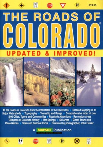
You might pick up this book: http://www.amazon.com/The-Roads-Colorado-2nd-Edition/dp/1569663599
It has decent maps to get you to trail-heads all over the state and it has land management information. Keep that map in your 4x4 and take the U.S.G.S 1:24K maps with you on the trail.
April seems too early to me.
maps (two maps, one covers the northern part, the other the southern part. The maps have campsites, portages, rapids, etc):
https://www.amazon.com/Allagash-Wilderness-Waterway-Geographic-Illustrated/dp/1566955874
https://www.amazon.com/Allagash-Wilderness-Waterway-Geographic-Illustrated/dp/1566955866
guide book:
https://www.amazon.com/Allagash-Guide-Famous-Waterway-Legendary/dp/156523488X/ref=pd_sbs_14_t_1?_encoding=UTF8&psc=1&refRID=34QBAVHEX9M4JHCG4115