(Part 3) Best hiking & camping guides according to redditors
We found 322 Reddit comments discussing the best hiking & camping guides. We ranked the 178 resulting products by number of redditors who mentioned them. Here are the products ranked 41-60. You can also go back to the previous section.


You're certainly in the right state. I'm guessing you're looking for established campsites with fire grates, as opposed to dispersed camping? Are you in the cities?
The Superior Hiking Trail is my recommendation for that remote feel. It runs all the way from Duluth up the north shore, with several starting points, parking lots, etc. I highly recommend picking up the guide book, which describes campsites, terrain, and water sources.
Beyond that, I know the MN DNR site has the ability to filter by use-type and activity. Look for hike-in sites. Several state parks have remote sites approximately 1-3 miles along the trail. But the SHT is my vote for pure beauty, and it can be done as a single night or a multi-day hike.
If you want truly remote, there is nothing better than the BWCA.
The best place to check out local hiking books is your closest REI.
Here are a few of my favorites:
Moon Guides: Camping CA, Hiking CA
These are the most general as they cover the whole state.
Robert Stone: Day Hikes Around Los Angeles
This is just one of many hiking books he has in CA.
Schad Afoot and Afield: Los Angeles County
Schad: Afoot and Afield: Orange County
Harris: Afoot and Afield: Inland Empire
Shad/Turner: Afoot and Afield: San Diego County
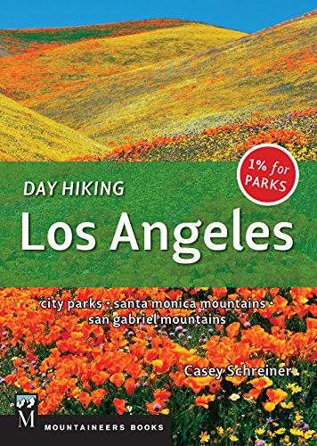
Casey Schreiner: Day Hiking Los Angeles
Casey is the new kid on the block. He runs the Modern Hiker blog
Robinson/Christiansen: Trails of the Angeles
Robinson/Harris: San Bernardino Mountain Trails
Since you are in Arcadia you should visit the Theodore Payne Foundation. They are a
CA native plant nursery. They have a short hike on their property. They should be able to hook you up with some good hikes in the area, and a hiking club.
Based on your reply I'd stick to Seattle and ONP. It really is fantastic. You can Google around and find lots of info including the Hoh Rain Forest, La Push, Sequim, Dungeness Spit, and much much more in the park itself.
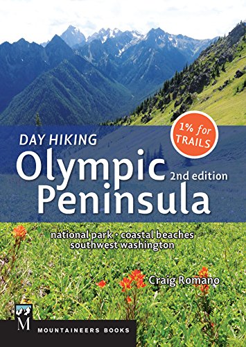
The Washington Trails Association Web Site is a great resource for hikes. For day hikes you might want to buy this book. It's a well known local resource and very very good.
https://www.amazon.com/Day-Hiking-Olympic-Peninsula-Washington-ebook/dp/B01N6HQV5P/ref=sr_1_7?ie=UTF8&qid=1543120699&sr=8-7&keywords=hiking+olympic+national+park
If you have a buddy and a car, the Cheakmus Lake-Black Tusk crossover is great. 26km but it is point to point. You would need to get a ride back to your car. Check out the [rubble creek classic] (http://www.escaperoute.ca/Rubble-Creek-Classic_ep_44.html).
Overall, I would say that most trails are wet-weather friendly IF you know what you are doing (really know, not just pretend know). Get [Matt Gunn's book] (https://www.mec.ca/en/product/5009-081/Scrambles-in-Southwest-British-Columbia) as well as [103 hikes] (https://www.amazon.ca/dp/B006ZNECRS/ref=dp-kindle-redirect?_encoding=UTF8&btkr=1).
Make sure you check the Whistler/Blackcomb forcast before going out though. You will be surprised at how quickly rain turns to wet, sloppy, painful snow.
I was just there <1mo ago.
Don't expect any cell reception in the park. The ranger stations have wifi but that's going to be your only chance to communicate out.
https://www.amazon.com/Hiking-Big-Bend-National-Park-ebook/dp/B00WJM04WQ/ Is a really handy book. It gives you info on all the trails, difficulty, how good they are, etc. Plus you can reference it whenever you want w/o having to make it over to a ranger station.
I'd also pick up a map at a ranger station. They mark all the roads and which need 4wd/high clearance.
I took US90 in because it seemed a more interesting drive than I10, but they do have a customs checkpoint on the way in if you take that way and are concerned about that.
Here it is in the UK Amazon store. I don't know whether it will be free in other country-specific Kindle stores. I think it is, but double-check that it's free before you download it.
EDIT: Also, because the book is brand new, I'd really, really appreciate a review if you enjoy the book. Thanks.
EDIT 2 (copied from an earlier reply in the thread): You don't need a Kindle to read the book. You can download and read it on any of Amazon's free Kindle reading apps. There are apps for just about every tablet, smartphone, and computer out there. If nothing else, you can read it in your web browser through Amazon's Cloud Reader.
Thru-Hike the Superior Hiking Trail: A comprehensive guide about planning, resupplying, safety, bears, bugs and more https://www.amazon.com/dp/B07QNBLB8S/ref=cm_sw_r_cp_api_i_CKeHDb8YDHXXJ
Get the Kindle app for your phone and you’re set and can even reference it from the trail. Resupply info, by itself, is well worth the price of the book.
Two books I have found useful: Best Easy Day Hikes - Lake Tahoe and Five-Star Trails around Lake Tahoe.
Ballard avenue would be good for quaint with restaurants, shops and a couple music venues. There is a farmer's market there on Sundays. Broadway/Capitol Hill is close to downtown and safe enough in daylight hours. The Pike Place Market is a tourist standard and is much less crowded in winter. Discovery Park has great views. Take a ferry for great water views at low cost. The ferry to Bremerton is about an hour. The boat to Bainbridge Island is about 30 minutes.
If you have a car and want to get out of town, there is a "book" with a deck of cards with hikes https://www.amazon.com/Winter-Hikes-Deck-Mostly-Snow-Free-ebook/dp/B00NMMO7C0/ref=dp_kinw_strp_1
Or visit http://wta.org and search for winter hikes there.
Here are all the local Amazon links I could find:
amazon.com
amazon.co.uk
amazon.ca
amazon.com.au
amazon.in
amazon.com.mx
amazon.de
amazon.it
amazon.es
amazon.com.br
amazon.nl
amazon.co.jp
amazon.fr
Beep bloop. I'm a bot to convert Amazon ebook links to local Amazon sites.
I currently look here: amazon.com, amazon.co.uk, amazon.ca, amazon.com.au, amazon.in, amazon.com.mx, amazon.de, amazon.it, amazon.es, amazon.com.br, amazon.nl, amazon.co.jp, amazon.fr, if you would like your local version of Amazon adding please contact my creator.
Also check his other books, for example this is free currently and I think the PCT one too:
Getting High: The Annapurna Circuit in Nepal
https://www.amazon.com/Getting-High-Annapurna-Circuit-Nepal-ebook/dp/B00CGMZ1O0/
[update]
PCT: https://www.amazon.com/Skywalker-Highs-Pacific-Crest-Trail-ebook/dp/B004HZXYX4/
Dead Men Do Tell Tales
Matthew Brady - Portraits of a Nation
Exploring the Appalachain Trail : Hikes in the Virginias
The hilarious, true story of a 750 mile pilgrimage in Japan, an unprepared office worker, and everything that went wrong along the way."
Fighting Monks and Burning Mountains: Misadventures on a Buddhist Pilgrimage
Kindle: $2.99
Print: $14.99
Audio: $19.95
For your lens kit I would recommend the following kit:
Depending on the weight of the 70-200 f2.8 you might want to bring the f4.
&#x200B;
I frequent JTree VERY often (about 1x a month in the winter months) there is SO MUCH to do in that park, I highly recommend this book for things to do and look at. Let me know if you have any questions about things to check out and or see.
Water in the desert only comes in two ways. Too much or too little.
I recommend reading: https://www.amazon.com/Grand-Canyon-Survival-Gear-Practical-ebook/dp/B00FOHV0PI/ref=la_B001K8UA0Q_1_12?s=books&amp;ie=UTF8&amp;qid=1493073589&amp;sr=1-12
A Guide to the Waterfalls of Iceland
Be prepared for snow! We went in mid-June to Yellowstone once, and it snowed maybe an inch.
There's a really good guide for hikes in all these National Parks I like, the best easy day hikes series (here is the Yellowstone one). I think these are great especially because the parks don't have much cell coverage! If you can't order them in time to where you live, most bookstores in Jackson or Montana would have them.
Also random thing, but one thing I love to promote to people is the National Parks Passport program. You buy one and then get a stamp at various ranger stations etc- nice little souvenir, and you can get a few on your trip! Some people get really into it is why I mention it. :)
Uk hiker here too. I just bought this book https://www.amazon.co.uk/Appalachian-Thru-Hikers-Companion-Robert-Sylvester/dp/1944958010/ref=sr_1_fkmr2_1?ie=UTF8&amp;qid=1509698330&amp;sr=8-1-fkmr2&amp;keywords=official+thru+hikers+companion.
Sorry I'm on a tablet and its hard/I cba to format.
Its a good book with all the information on facilities and resupply points without a crazy price.