Best hiking & camping guides according to redditors
We found 322 Reddit comments discussing the best hiking & camping guides. We ranked the 178 resulting products by number of redditors who mentioned them. Here are the top 20.
We found 322 Reddit comments discussing the best hiking & camping guides. We ranked the 178 resulting products by number of redditors who mentioned them. Here are the top 20.


Youtube is loaded with videos on the subject:
https://www.youtube.com/results?search_query=Map+and+Compass+Skills
Also: http://www.amazon.com/Staying-Found-Complete-Compass-Handbook/dp/0898867851
http://www.amazon.com/Wilderness-Navigation-Finding-Altimeter-Mountaineers/dp/1594859450/ref
http://www.amazon.com/Expert-Map-Compass-Bjorn-Kjellstrom/dp/0470407654/ref
One great practice to get into is to use your more advanced navigational aids primarily to confirm or correct what you have already determined by more basic methods.
For instance, get used to reflexively observing your surroundings (Especially stopping every 100 paces or so to look at and study your back trail). Practice estimating the distances/direction that you have walked and the times elapsed. Become aware of the position of the sun or the prevailing winds (Observing the effect that these winds have over time on local vegetation).
Even jets flying overhead can provide clues as to general directions. In my area of Upstate NY, the vast majority of jets flying at altitude maintain a roughly east/west flight path. Even on a cloudy night when the stars and the moon are totally hidden, I can often see the lights of jets blinking through the cloud cover, giving me a clue as to whether or not I have begun traveling in a circle in the dark.
A GREAT read: http://www.naturalnavigator.com/tristan-gooley
http://www.amazon.com/Natural-Navigator-Rediscovered-Letting-Nature/dp/1615190465/ref
Several times a day, without looking at your map estimate your location and heading direction/distance to your starting point and your destination. Once you have done this, take out your map and confirm your estimates. If you have a good vantage point, take several bearings with your compass on significant features (Focusing on contour features on your topo map) and then triangulate to determine your location.
The most important practice is to primarily rely on your GPS as a means of confirming and correcting your earlier navigational estimates. As you get more accomplished and as your confidence levels rise, you will find that observational navigation will become second nature to you.
I live in Arizona and can confirm that a lot of people disregard those signs.
It's dark, but our local subreddit a year or so back even had a poll on where we thought the first dead tourists of the season would be from.
If anyone's interested in reading more on the topic, this book is a really good read. I convinced my mom to get it for me when I was a kid, and while it was a bit of a morbid read for someone so young, it really teaches you not to underestimate the desert.
Near Eugene? Or in Eugene? We're a pretty small city, so living near work is pretty swell as you can get around by bike and save on gas. 15th and Lincoln is a good area, had a grad student friend who lived there. You're far enough away from campus that it's mostly grad students and less noise, but still pretty close to downtown. Where to live depends on your goals though, proximity to work, proximity to restaraunts/bars, bike friendly, quieter, safer, etc etc.
As a Columbus transplant myself, you'll probably find it a pretty easy transition (at least I did). Some notes:
Darn Tough socks, Membership to the Appalachian Trail Conservancy, REI gift certificate those seem like solid gifts.
Edit: How could I forget Andrew Skurka's [The Ultimate Hiker's Gear Guide] (http://www.amazon.com/The-Ultimate-Hikers-Gear-Guide/dp/1426209207)?!
I recommend reading Appalachian Trials by Zach Davis: https://www.amazon.com/Appalachian-Trials-Psychological-Emotional-Thru-Hike/dp/0985090103/ref=sr_1_1?ie=UTF8&qid=1506807365&sr=8-1&keywords=appalachian+trials
http://www.vancouvertrails.com/
http://www.amazon.ca/103-Hikes-Southwestern-British-Columbia/dp/1553653742
City Walks: New York: 50 Adventures on Foot
Do it!
I think most people can physically achieve a thru hike. Its definitely more of a mental challenge. There is a great book called Appalachian Trials which I would highly recommend reading if you are seriously considering an AT thru hike
If you haven't read Appalachian Trials: A Psychological and Emotional Guide To Thru-Hike the Appalachian Trail I would highly recommend it
I like Valley Falls in Vernon. Mansfield Hollow is solid. Backpacking up at Bear Mountain in Salisbury.
In the south, I really love Westwood Reserve in Guilford.
I'd highly recommend you pick up AMC's Best Day Hikes in Connecticut, they have some great recommendations all over the state, including specific loops and what's on them.
No. No one backcountry water purification method can handle every single situation. No filter is capable of removing ALL chemical contaminants (some remove none), and many filters do not remove viruses. If you are hiking in North America viruses are not generally considered a problem. (See: 1)
You don't. But you can minimize the risk by only purifying water that you would feel reasonably comfortable drinking without purification -- eg: running water, no funny smells, some small wildlife living in the water (lack of toxins), no strange colors.
Depending on weather and conditions, I'd go with no less than 3 liters per person for an all-day (dusk to dawn) affair. SectionHiker goes into great detail about managing water on a hike.
You can buy maps at a local outfitters, from National Geographic, or download and learn to read the USGS maps. If you are asking this question, you should also learn how to stay found -- I recommend Be Expert with Map and Compass
Ask the regulatory agency responsible for the lands you are on.
For pooping: Dig a hole with a small trowel about 8 inches deep and 6 inches wide. Do your business. Put your toilet paper in the hole, and using a found stick mix it up with a splash of liquid (pee or water) and some dirt. Cover the hole thoroughly and pack it down. For peeing: Take care to pee on rocks or sturdy trees. Don't pee on fragile plants.
Biodegradable soap or Dr. Bronners if you must use soap. Most people use Purell instead to save water.
Consult the regulatory agency responsible for the lands you are on or local experts (gear stores).
Leave them alone. Make plenty of noise so you don't surprise them. If you are wearing your pack and attacked by a stalking-type animal, curl up into a ball and cover your neck and get on your hands and knees. Cook and store your food about 50 feet downwind of where you make your camp.
(1) Water purification: Keep in mind that none of these will work on chemicals found in the water like arsenic or toxins made by blue-green algae.
If you do three consecutive years, you won't really need to worry about getting in shape, just staying in shape during the off seasons (I assume you won't be hiking in the winters). If you live in the south, you can still get outdoors to hike. If you live in the north, then treadmills and stair steppers are the way to go if you can't stand the cold (like me). The bigger concerns, at least for me, are personal health and money. Injuries and sickness happen, so you have to avoid those. And you need to make sure you're insured while on the trail. You also won't have much, if any, income for 3 years. That's tough. I have an AT thru-hike slated for 2015 and a PCT thru-hike for 2016, but it's already tough on me financially. Things keep popping up and eating into the PCT fund.
For general long distance hiking, here are some of my favorite books:
Andrew Skurka
Michelle Ray
Jan Curran
The Logues
I've found the book "A Ranger's Guide to Yellowstone Day Hikes" by Roger Anderson and Carol Shively Anderson to be very useful in assessing the difficulty and distance of the many hiking opportunities in Yellowstone: https://www.amazon.com/Rangers-Guide-Yellowstone-Day-Hikes/dp/1560371579
They're kids. Pull up by a small stream and let them play in it. Thats what my kids always wanted to do.
Fishing, too. Get yourself a small spinning rod and a some single hook spinners, pull off the road where Soda Butte Creek meets the Lamar River and toss it in. I bet you catch a fish. There are numerous opportunities to do some light fishing in the park. You'll need a license, but the kids don't (I think...check at the park office).
I'd recommend either Andrew Skurka's book or Dan Ladigan's book.
Andrew Skurka's website is also a good resource.
The Backpacking Light forums are excellent.
Ten Pound Backpack is pretty helpful for gear comparisons, once you know roughly what you're you're looking for.
For a complete beginner I usually recommend you pick up a book. There's so much information that it's hard to get anything from Reddit replies. Backpacking becomes a very personal activity after a few years and everyone has different ideas about the best set ups for gear and what not. So start with one of these books and really get an understanding of all the different types of gear. Also if you're in the states and have an REI close by you should see what kind of courses they offer. Most REI's have some kind of free intro to backpacking course. If you're cautious and prepared, going solo is just as safe as going in a group.
The top 3
The Ultimate Hikers Guide
The Backpackers Field Manual
The Complete Walker IV
The first one is probably the most easily digestible. The 3rd is my favorite but that's just because I enjoy the writing style. It's also arguably the most comprehensive.
I'd suggest you grab one or more of those books and start getting an understanding of all the gear. You could start with some easy overnight trip.
Edit: I just want to add, if you've never been backpacking at all you should look into gear rental and plan a quick trip. I've known plenty of people that think they want to do it until they do and they hate it. REI's have gear rental, some colleges have Outdoor Rec departments that rent gear. You could also look for a meetup.com group near you and message them about wanting to learn. I used to go out with a Meetup group and we would always gladly put a bag together for someone wanting to try it out.
Buy these books before you spend any more money on anything else. They can save you a lot of money over the course of your upcoming months of gear-nerding out.
http://www.amazon.com/Ultralight-Backpackin-Tips-Inexpensive-Lightweight/dp/0762763841
http://www.amazon.com/The-Ultimate-Hikers-Gear-Guide/dp/1426209207
I found Michelle Ray's book, How to Hike the A.T.: The Nitty-Gritty Details of a Long-Distance Trek, invaluable to my preparation. Not knowing anyone who had any long-distance hiking experience, this was the next best thing.
Hey there, I think I may be able to help you!
I spent a month in Japan hiking and hitch-hiking, as well as over 6 months living/working there. Mt.Fuji was very high on my to-do list, but I'd missed the season and was strongly advised against doing it, despite having a fair level of experience and being just about a month too late. The official season is from July 1st - August 31st. It's fairly obvious why you can't go in winter, and the main reason for being unable to go in Autumn and Spring would be unreliable/bad weather and the facilities closing down. People do go outside of the season of course, and one of the best times may be two weeks either end of the season - you won't be fighting the crowds, conditions should be alright.
As for going in May, I would advise against it and wouldn't do it myself despite having done plenty of hiking elsewhere. As far as I know, nothing is physically stopping you going whenever you want, so it will never be closed as such. Some enthusiasts (and professionals) will go up mid-winter.
I'll answer the rest of your questions anyway though, and then give you a few pointers/other ideas.
Getting There/Base
Getting a train or bus from Tokyo is easy, there are plenty of them (a lot more during the season though). A bus would be cheaper. I don't think you'll be able to get public transport to the 5th base (where most people hike from to the top) easily off season, so it might require taking a return taxi from Fujiyoshida. If you want more specifics, I can look into this quite easily. If you're not travelling onwards and further south, or planning on staying in the area, it's very easy just to use Tokyo as a base. I'm pretty sure this is the thing most people do - just make it an overnight trip from Tokyo.
Sunrise/Sunset
Sunrise is the one people go to Mt.Fuji to see, and in season most of the transport from Tokyo is geared up for this - they'll take you to the right place to walk up in time for the sunrise, then you can hike back down and get back.
Alternatives
Like I said, I don't think going in May is the best of ideas unless you have a good level of experience under your belt. If you decide to go ahead with it, make sure you leave your information with the police in Yoshida.
A great alternative would be doing a hike in the Fuji 5 Lakes area. This is at the base of Mt.Fuji, so you'll have amazing views of the mountain and the surrounding area. I haven't hiked there myself, but I can find more info if this sounds interesting to you. You can do this as a day trip from Tokyo, or spend a little longer if you have the time.
From your post it sounds like you're looking for a 2 day trip from Tokyo with hiking involved. A place I can't recommend enough would be Nikko National Park a few hours by train to the north of Tokyo. You'll be spoiled for choices of things to do here and I would go again at the drop of a hat. There are some amazing hikes around the area and plenty of shrines and historical sites to see as well if that's your thing. One hike near there which I did takes you through a stunning marsh with all kinds of flora and leads to the hot spring town of Yumoto Onsen, a great place to soak your bones after a long day's walk. Again, if you'd like more info about these places just ask and I'll flesh it out a bit more.
Further Info
You're probably going to be disappointed in the responses you get to this question. "Best Gear" is sort of like asking for best ice cream flavor, or best color - you're going to get a lot of opinions based on personal preference, but very few hard-and-fast "best" verdicts.
Best Gear will be whatever works for your needs and hiking style. Take sleeping pads for example: my "best" might be a luxurious thick, heavy pad so I can sleep really well and rest my sore back, but your "best" might be a super thin and light pad to reduce your pack weight. Both are right answers, just for different reasons.
But the good news is you've got time. You can start researching, and doing little test trips to try out different things to see what works for you. If you want to get started learning about gear, and the philosophy behind it, Andrew Skurka's book is a pretty good read.
The only other official resort in Idaho is Sun Meadow in Worley, 260 miles from Boise. Oregon has a few, but I don't know if any are in the Eastern half, so it depends on how far you're willing to drive. Utah has none, haven't heard of any in Nevada. Don't know about the other neighboring states.
Idaho's big advantage is the hot springs. It's known for having some of the best hot springs in the country, and many of them are traditionally clothing optional. The trick is that none of them, to my knowledge, are officially clothing optional, so it takes familiarity and experience to know which ones are nude-friendly in practice and which are not. I have two books, Hiking Hot Springs in the Pacific Northwest and Hot Springs and Hot Pools of the Northwest, that have extensive information on the whole region, including notes on the trend of clothed vs nude at each one, but I take that with a grain of salt given that it's been a few years since the most recent editions. I can't advise on any of the Idaho springs, since I've really only gone to one in Oregon. It's closer than any of the Idaho springs, but it's a mixed bag at best when it comes to nudity.
This is an awesome book on Grand Canyon deaths and I read it before my trip there. I was scared to get within 5 feet of the edge of any drop.
Make sure you get up early (like 7 am) and head to Lamar Valley look for a parked cars and you are sure to see Wolves or a Grizzly. This was the best thing I did while I was there
My 2nd piece of advice is do some off road trails. Yellowstone really awards you for putting in the work. We had to hike about 9 miles to see Fairy Falls and it was totally worth it. There's also one we did that goes behind Mammoth hot Springs and gives you way prettier views with no one around. Theres a loop when doing wthe southern canyon trail that allows you to see some really cool thermals. this booke offers a lot of great options
https://www.amazon.com/Rangers-Guide-Yellowstone-Day-Hikes/dp/1560371579
When doing any major attractions I would just try to get there early. Getting to Biscuit Basin around 8 or 9am allowed for easy parking and less crowded boardwalks.
I would defnitley make a point to get down to Tetons. Its really chill and peacful there. We stayed at Signal Moutain campground and the lodge seemed like a nice place. People wroking there were very cool and helpful. Also if you enjoy craft beer Melvin in Jackson is one of the best brewries in the country.
Others have mentioned William Sullivan's guidebooks, this one is virtually the hiking bible for our area. There is a newer version that I couldn't find on Amazon, but has recently been made available at REI.
If you plan on staying in Eugene for awhile that book is worth every penny. Just make sure to be a respectful hiker if you buy it, many of the trails that he lists used to be fantastically secluded, but have recently become much more popular.
Tim Homan's book, "The Hiking Trails of North Georgia." It's a little dated now, but still a good resource.
https://www.amazon.com/Hiking-Trails-North-Georgia-Homan/dp/1561451274/ref=sr_1_1?s=books&ie=UTF8&qid=1526949642&sr=1-1&keywords=tim+homan&dpID=61HSRFK2R8L&preST=_SY291_BO1,204,203,200_QL40_&dpSrc=srch
This book is pretty good https://www.amazon.com/gp/product/1934028770/ref=oh_aui_detailpage_o00_s00?ie=UTF8&psc=1
Book 1 is good.
Try these as well
Book3
Book 4
Book 5 - I have not read this book but I trust the author
I'm reading this book now: Expert with Map and Compass and then will be look at this one: Wilderness Navigation
edit: readability
Anywhere in the Columbia River Gorge is always beautiful. Eagle Creek and Hamilton Mountain are two of my favorites. Check out this book for some of the best hikes in the area.
So spent a fair bit of time (4 weeks) wandering the Khumbu (Everest) Area a few years ago. I didn't climb any technical peaks, but I got up to 5800m on Chukkung Tse (it was a fairly easy walk to the top).
If you are a competent hiker/route finder/traveler, I would recommend going alone. There were some people who I met along the trail that had guides, they seemed hit or miss. Some were awesome and would help the clients do whatever they wanted, some were a bit too controlling for my tastes.
For costs I took a ~$5 bus to Jiri and walked into the Khumbu, very nice, cheap, tons of very friendly Nepalis and virtually no other trekkers, but not feasible if you've got limited time and/or a lot of gear. Daily costs were around maybe $10 a day. If you find a group of people you can negotiate prices (if the 6 of us eat here will you give us the room for free). Cost to fly in or out of Lukla ran about $200 one way I think, I flew out instead of walking out.
As for climbing, most of the 6000m+ peaks are called "Trekking" peaks. The most common one to climb is Island peak. From what I've been told it was super cool to climb those, but you NEED a guide. There are a lot more permitting issues than for a simple trekker like myself. You'll have to go through a local company. My suggestion if you are set on climbing one of those peaks is to hang out in Thamel (tourist region of Kathmandu) and find westerners who have dealt with local companies. You'll save a boat load of cash over booking through a western agency and you'll get to meet the people in charge before you put down money. If you get a bad vibe, just walk away. For guide companies, I would first suggest Ang Rita Trekking: http://www.angritatreks.com/. The manager, Mingma, helped organize the trek my parents met in the late 70s and became a family friend and helped me tremendously when I was there. It's also cool because he was born in the Khumbu and his son is now a guide. I never did an actual trek with them, but I can vouch they've been a stand up organization for 35+ years.
For the Everest Area the best guide book by far is Trekking in the Everest Region By Jamie McGuinness. Especially if you are just trekking on your own this guide is invaluable.
PM me if you have any questions
Here are some links for the product in the above comment for different countries:
Amazon Smile Link: Trekking in the Everest Region
|Country|Link|Charity Links|
|:-----------|:------------|:------------|
|USA|smile.amazon.com|EFF|
|UK|www.amazon.co.uk|Macmillan|
|Spain|www.amazon.es||
|France|www.amazon.fr||
|Germany|www.amazon.de||
|Japan|www.amazon.co.jp||
|Canada|www.amazon.ca||
|Italy|www.amazon.it||
|India|www.amazon.in||
To help add charity links, please have a look at this thread.
This bot is currently in testing so let me know what you think by voting (or commenting). The thread for feature requests can be found here.
The brown book...
My SO and I stayed at the Norris campground, which was great. It's pretty central so we were able to do things like drive down to grand tetons for the day and not have to move campsites often. We stayed at Gardiner the night before and woke up early to drive to the campsite. We got there 45-30 mins before they started accepting check-ins, and we were like 8th in line.
If you're doing first come first serve plan to get there EARLY to get your site.
As far as hikes, my personal favorite was Elephant's Back, you get an incredible panoramic view of Yellowstone lake, and almost nobody goes up there.
We didn't plan a ton in advance. We had a copy of this book: https://www.amazon.com/dp/1560371579/ref=cm_sw_r_cp_apa_axoizbA48SK5T
And just picked a region and picked a couple of hikes to do during the day based on distance, views, etc. Worked really well.
I've got a few falcon guides, they're ok but they seem like they were written by someone looking at topo maps and not someone who walked the trails.
This book is much better, it's in fact the best hiking guidebook I've ever used and I've used a lot. http://www.amazon.com/Hiking-Trails-North-Georgia-Homan/dp/1561451274
Tim Homan actually walked every trail in this book, took notes, then went back and hiked every trail in the book again while using one of those roller mile counter thingies to calculate mileage.
I saw it at the Museum of Arts and Design but ended up putting it on my Amazon wishlist instead of buying it there.
This is the link, it actually dropped a dollar or so in price since I last looked on Sunday.
I love the Smokies. My favorite campground is the Cattaloochee horse camp (there's a non-horse camp there too). I love it because there are elk in the area that sometimes even wander into camp! The downside is it's a long drive up the side of a mountain on a narrow twisty road.
My other favorite campground is Elkmont. It's a pretty popular frontcountry campground but there are a LOT of trails to hike right out of the area so you don't have to drive to a trailhead. There are RV sites, tent sites, and walk-in tent spots (you park your car and carry your tent/supplies a short distance to your site).
There's also backcountry camping with a permit. You are supposed to use recognized sites and bear precautions everywhere in the backcountry.
All frontcountry campsites require a reservation. Sometimes backcountry areas are closed due to bear activity so check with the ranger station before you set out for your destination.
I totally recommend you get this trail guidebook, it's the best trail guide I've ever read for any state/national park.
Hiking Trails of the Smokies https://www.amazon.com/dp/0937207152/ref=cm_sw_r_cp_apa_i_RzNYDbTPWSRC8
I highly recommend Appalachian Trials! to any prospective thru-hiker. I'm reading it for my third time now and I feel that, going into the my hike next year, I already have a major advantage.
http://www.vancouvertrails.com/trails/
I liked this book too 109 Hikes of the Lower Mainland
Here's one I haven't read but it's the same author: 103 Hikes Southwestern British Columbia
Hundreds of possibilities .. easy ones are Lynn Canyon, Cap, Stanley Park, Lighthouse Park, do all the beaches, Minnekhada, Colony Farm, Seymour Demonstration forest, +1 on Pacific Spirit, Deer Lake
So I asked a similar question to the LSHT Facebook group way back in the day, and they suggested the book I'll link below. Basically they said this book was written more recently, where as the one you linked is somewhat dated. The one I have gives really good information about the trail, as well as general tips for backpacking, and how to plan trips. Very beginner friendly stuff. Lol. But still helpful to me when I was starting out. If youd like, you can PM me your address and I'll let you have my copy: )
Plan & Go | Lone Star Hiking Trail: All you need to know to complete Texas’ longest wilderness footpath (Plan & Go Hiking) https://www.amazon.com/dp/1943126011/ref=cm_sw_r_cp_apa_i_1w-QCbEER24BK
So I was drafting a blog post on books this weekend. Copypasta:
Ultimate Hiker's Gear Guide - Andrew Skurka
Ultralight Backpacking Tips - Mike Clelland
Lightweight Backpacking and Camping - Ryan Jordan
Trail Life: Ray Jardine's Lighweight Bapackpacking
Beyond Backpacking: Ray Jardine's Guide to Lightweight Hiking
There are tons and tons of things to do and see in Yellowstone. If you just stick to the backcountry you'll miss a lot. You could spend 3-4 days just doing the more touristy stuff. I bought this book to help figure out what hikes to do. Mt Washbourn was an awesome day hike. There was a place where the Boiling river met with a much colder river and you could swim in it. That was a lot of fun. The hike to the petrified trees in the northeast corner of the park is a great hike to go on and get away from the crowds. The park is basically two giant circles. I'd start at one end and go around until you hit everything.
As for camping I'd recommend making a reservation at one of the camp site now. You can't just pull off the road and camp and will probably need a permit for any backcounty sites. I stayed at the Canyon Campground last time I was there and it was a great camp site. Make reservations at campsite near the stuff you want to do and leave early or you'll sit in bear jams for hours....
http://www.theatguide.com/
http://www.aldha.org/companion.html
You could try this one, but I've never used it:http://www.amazon.com/books/dp/0811735427
Check the sidebar of this subreddit--lots of good info there.
This book has what you're looking for: http://www.amazon.com/AMCs-Hikes-Catskills-Hudson-Valley/dp/1934028452
First, yer gonna die. I say this only partially in jest, because your question indicates you haven't done the initial research on your own, and I can make a fairly good guess at how the story will play out, particularly if you were to attempt it this late in the year.
Now that that's out of the way, I suggest you start with these two books:
You'll also need to learn how to use a map with both compass and GPS. (That link is just to get you started.)
As others say, you need to do smaller trips at the very least to know what you can carry and how much elevation and distance you can cover in a day. If you don't know that, you can't budget your food and fuel, and so you'll fail. You also need to test all your gear beforehand. Oh, and leave a note with someone.
Um. no. It's really not. It's a fantastic book, written by arguably one of THE best hikers in the world. Andrew Skurka. The book answers the types of questions many people come here and ask like: 'hey, I'm going X, what type of gear is best for this trip'. Take a look inside at Amazon http://www.amazon.com/Ultimate-Hikers-Gear-Guide-Techniques/dp/1426209207#reader_1426209207 Sure, he names some specific product names...but there is far more information on just general gear selection in there.
I don't know too much about it but there is lots of hiking in most areas of Japan. If you can find it check out Lonely Plant's Hiking in Japan book or something similar. There isn't too much detailed information on hiking in Japan in English that I know of. Maybe someone might know of a good info site.
Second the Appalachian Trail tip with an additional shoutout for the ATC paperback book that serves as a MA/CT guide. It points out loads of detail on trail areas as well as identifying trail shelters and primitive campsites.
The tough thing about finding good dispersed camping in CT is basically that it's all there out in the open but there aren't a ton of good resources for organizing that information. I've been trying to figure this out myself a lot more recently because I just moved back from living in PA a long while. Most of what comes up when you look online is what appeals to RV campers and families: KOA campgrounds and the like. That's where business is so that floats to the top of a web search.
I'd suggest starting with this one, and then also you might find some info here, but even though the second book is mostly focused on day hikes it still identifies places to camp, if i remember correctly.
As for specific places, I can recommend Sage's Ravine, which sits on the MA/CT border. There's a nice set of sites there and it's all easy to use. There are bear boxes for protecting your food without having to rig a bag. I'm also fairly sure there's a no campfire policy. I wouldn't suggest messing with that if you plan to go, though I'm also fairly certain I've seen some people with small fires there now and then.
It's not too complicated, you could also just pick up a book like this one.
Get yourself a copy of this book or this one and just start banging them out. Pro tip: don't just look in Oregon. At least half of the best hikes in your radius are in Washington. Both of those books have solid southern Washington sections.
Speaking of Washington, I wouldn't take the time to drive to Crater Lake until you've been to Mt Rainier and Mt St Helens. Both are closer to Portland and I my opinion more interesting areas to explore.
I'm not spending a single weekend in the city this summer and I couldn't be happier.
No problem, for planning 100% buy this book:
https://www.amazon.com/Tour-Mont-Blanc-Complete-trekking/dp/1852847794/ref=pd_lpo_sbs_14_t_0?_encoding=UTF8&psc=1&refRID=N26P7HE46ES9PEQF16M5
Also, book way ahead of time to make sure you get the huts/hotels you want. It's possible to find lodging day-of, but you'll never know where and you likely won't get the accommodations you're looking for (unless you're tent camping the whole thing)
Further, try to work it out so you stay the night at Les Mottets, Bonatti, and Lac Blanc (our favorites) and skip Elisabetta if you can help it as it was our least favorite night.
http://www.amazon.com/Hiking-Hot-Springs-Pacific-Northwest/dp/0762783702/ref=sr_1_2?ie=UTF8&qid=1452037899&sr=8-2&keywords=idaho+hot+springs
I was introduced to hiking in one of the most mindblowing hikes of my life - the Obsidian Trail near Sisters, OR. It's best described in this book: 100 Hikes in the Central Oregon Cascades
You cross a lava field, pick up a little of the PCT, check out alpine meadows with streams and ponds, can basecamp and then climb up to a glacier, or just find a nice meadow and spend the night under the stars.
If I could choose a few day trip to do out there, I'd hike up, basecamp at the base of the middle sister, summit the next morning, hang out, and then hike out on the third day.
Here are a couple pics I took on that first ever hike.
There are almost unlimited amazing opportunities out there, this is just one and may not be what you're looking for - either way have a great time and let us know how it goes!
I'd go to Powells (or any other bookstore) and pick up William Sullivan's book on the area. He's got every sort of hike you could imagine in there. Also, check out Mount Jefferson Wilderness area, its really beautiful out there.
And links I throw out whenever someone asks for GSMNP info:
National Park Service site on the campsites
Another look at the campgrounds and back country sites
Clickable Trail Map (printed in 1997, anyone who's been to the park has seen this map.) It still doesn't beat the little brown book.
Downloadable Trail GPX files for GPS devices
Download maps from the NPS. Includes Trail, park, and campground maps.
And the NPS GSMNP Hiking page. Has some important information, including how to find out road and facilities closings.
Also check his other books, for example this is free currently and I think the PCT one too:
Getting High: The Annapurna Circuit in Nepal
https://www.amazon.com/Getting-High-Annapurna-Circuit-Nepal-ebook/dp/B00CGMZ1O0/
[update]
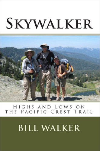
PCT: https://www.amazon.com/Skywalker-Highs-Pacific-Crest-Trail-ebook/dp/B004HZXYX4/
Well, for starters, I definitely recommend this guide for the area! The author is from Eugene and is extremely knowledgeable. His books are pretty much the Bible when it comes to Oregon hikes.
I've enjoyed every trip I've taken from that book into the Mckenzie foothills!Separation Creek and Sahalie falls are some highlights my wife and I have done recently. We're headed out to Olallie Mountain this weekend.
I don't have the book on me at the moment (at work) but it has a ton of great hikes in the area.
From McCall, you have trail Creek that is 20 miles out of cascade and then keep going out to warm Lake and hit up mile 16 springs.. That loop has about 10 or so springs in varying conditions and popularity. If you keep going further south towards Boise and turn on the banks-lowmen Highway and head towards crouch/garden Valley there are another 25 or so springs from there.. Crouch/garden Valley would be the real place to base out of if your going to do a trip specifically to soak.. From there my favorites are Kirkham, pine flats, pine burl, and skinnerdipper. Once again all varieties of conditions and popularity.
I highly recommend the Falcon Guide "Hot Springs in the Pacific Northwest" it's an awesome guidebook with all the info you need on any springs in BC/Washington/Oregon/Idaho..
EDIT: Here is the Amazon link. Sorry for the ugly formating.. On my phone.
http://www.amazon.com/gp/aw/d/0762783702/ref=pd_aw_sims_7?pi=SY115&simLd=1
Andrew covered that. Saves you from rebuying the whole kit until you finally get it right: https://www.amazon.com/Ultimate-Hikers-Gear-Guide-Techniques/dp/1426209207
Think about crossing into the U.S. and taking in the north Cascades area. The Mt. Baker area, in particular, has some fabulous hiking, but the best hikes might still be snowbound at that time of year. Also in the US, Mt. Rainier is absolutely incredible to see, but will be a bit more a trek from Vancouver, so may not be worth it given a limited schedule.
There are a lot of hikes in the Whistler, Pemberton, Duffey Lake Road corridor. This book has some great options to check out. You can camp at Nairn Falls Provincial Park, just south of Pemberton and that puts you 30 minutes north of Whistler and about 45 minutes south of Joffre Lakes. The drive up the Sea-to-Sky and through to the Duffey is worth a day, even if you didn't get out of the car.
Get the Lonely Planet like /u/the-invisiblefriend said. Also get this book, you'll be surprised how many walks there are that don't require a whole lot of fitness.
Also:
Now for some unhappier bits:
Lastly, do enjoy your time. Nepal, despite being not the most user-friendly of places, is an amazing, amazing place with lovely people and stunning views. You'll be back! :-)
It seems like you have a good grasp on what to expect on your trip which is great. I would suggest going to the hotel and saving the GTNP visit on your way to the airport.
Lamar Valley is a pretty big area and it's best to visit it early in the morning or at dusk as bears and wolves are most active at that time of day. If you see a bunch of people with spotting scopes and large camera lenses standing by the side of the road they are most likely observing one of those big animals.
If you want some books to help you with your trip, Yellowstone Treasures: The Traveler's Companion to the National Park is a very detailed one. For day hikes A Ranger's Guide to Yellowstone Day Hikes book is good and Trail Guides Yellowstone web site is an excellent source for all things Yellowstone.
Get these books:
109 Walks and
103 hikes
The directions/explanations aren't the best, but at least it will give you ideas. And lots of the listings are not super well known, so often it's less crowded. I like just flipping through and picking a random spot. The walk book has walks that can take from a couple to many hours, but the hike book has major hikes - many of them are carry-in camp style for more serious hikers. Happy adventuring!
Garibaldi Lake is really nice and not too far for a day hike. I did an over nighter and had to dig out a tent pad under a meter and a half of wet snow... that was a bit unnecessary.
103 Hikes is a good book for info. You can also pick one up at MEC I'm sure.
I recommend getting this guide book, it has lots of useful information https://www.amazon.com/Tour-Mont-Blanc-Complete-trekking/dp/1852847794/ref=sr_1_1?ie=UTF8&qid=1467369262&sr=8-1&keywords=tour+of+mont+blanc+cicerone
For a "Kickass view from the top" it is hard to beat Brasstown Bald. But, I like anything in the Cohutta Wilderness. The book Hiking trails of North Georgia is an excellent guide, and is probably available at a local library, or maybe a hiker you know has a copy.
Jack's River Falls Trail is one of my favorites. But... it's not known for it's long views. There are a couple of approach trails and AT side trails that are very nice, and have great views. Of course, the AT from Springer Mountain....
Top Book picks:
All but the absolute cheapest compasses have declination adjustment. A $9 Silva or Suunto has the adjustment and to suggest that someone needs to spend Brunton money to get an accurate compass is ridiculous (and I HAVE a Brunton). Fake edit: I just remembered that Brunton makes normal compasses and not just transits and geology tools, not all their products are $300+ although they’re REALLY nice!
My Brunton transit is the only compass I have with E/W flipped because it’s a direct read compass. None of my others, including my Suunto MC-2G read that way. The majority of compasses that anyone will ever have will read normally, there’s no need to complicate this.
Here is more compass than most people will ever need and includes the clinometer functionality of the higher-end Brunton compasses. Less than $40.
Spend half that on a cheaper compass and buy a book like this and/or this one (I have no preference, I own both) and spend some time with them.
Also, if you print your own maps it doesn’t hurt to invest in waterproofing, it also makes them last longer!
If you REALLY want to hone your nav skills, find a local orienteering club! It’s a lot of fun, and once you’re past the initial investment (a compass) there’s not really any other cost other than time.
Source: Have been wandering around in the woods for 30-odd years and have spent much time teaching other people to not get lost in the woods.
You can find the information in here for free on the internet, but if you are looking for a nice summation of everything you would have to track down piece by piece, check out How to Hike the A.T.: The Nitty-Gritty Details of a Long-Distance Trek
Here are 50 free self-guided walking tours of NY.
I found this book interesting
https://www.amazon.com/Appalachian-Trials-Psychological-Emotional-Thru-Hike/dp/0985090103/ref=nodl_
My goal is to be a 2019 NoBo, so I haven’t been out there yet, but the book was decent brain candy while waiting. Good luck!
Hehe yes, seeing Everest is something everybody should do once in their lifetime, like going to the Galapagos.
The prices on the Jagged Globe website include flight from the UK, but you can fly on your own from the US and join them in Kathmandu, or maybe ask them to book a connection in London for you. Don't hesitate to get in touch with them with that kind of issues, they will be glad to help.
Except on summit days, we rarely do more than 5 miles a day and gain 1000-1500 feet at most, since going any faster would lead to altitude issues. Most people will be ok (though everybody will suffer to some extent) but some are just unlucky and come down with bigger health problems. One member of the group had to be helicoptered out as he had a very worrying chest infection that required immediate medical attention. It's quite rare, but it does happen.
You will probably like my photo essays from the trip (the Khumbu Diaries), it gives a day by day account of the expedition. I also strongly recommend getting Jamie McGuinness's guidebook, Trekking in the Everest region, as it is very thorough and informative.
There are not really any hidden costs, except maybe for tips (which you are told about at the beginning, and usually doesn't exceed 50-70 USD) but anything out of the regular meals will be very expensive in the mountains, and a soda or a candy bar can become very tempting after a long day. I burned through 300USD in a month without indulging too much, and could easily have spent double that amount.
All the data says pepper spray is more effective than guns in bear attacks, so I'd lose that right quick. Second, read Ray Jardine, Justin Lichter, and Andrew Skurka.
http://www.amazon.com/Beyond-Backpacking-Jardines-Lightweight-Hiking/dp/0963235931/ref=sr_1_2?ie=UTF8&qid=1341345684&sr=8-2&keywords=ray+jardine
http://www.amazon.com/Trail-Tested-Thru-Hikers-Insights-Backpacking/dp/0984855009/ref=sr_1_1?s=books&ie=UTF8&qid=1341345701&sr=1-1&keywords=trail+tested
http://www.amazon.com/The-Ultimate-Hikers-Gear-Guide/dp/1426209207/ref=sr_1_1?s=books&ie=UTF8&qid=1341345724&sr=1-1&keywords=andrew+skurka
You will find every suggestion we could come up with on here and more. Personally I find ponchos to be a shitty option, and sleeping bags and quilts are very nice. If you're on the Kenai, you will want a bugproof shelter, too.
His two other books are free today, too.
All hikes I mentioned are 8+ miles over hilly terrain. The Gahuti is the easiest of the bunch.
I'd recommend picking up a copy of Hiking Trails of North Georgia.
Lone Star Hiking Trail, just north of Houston. Easy 7 day thru hike, 5 days if you do 20 miles a day (its been done in 3). No extreme terrain, little change in elevation. The biggest changes in elevation come when you get to a creek bed and have to climb down and then back out again.
No campsite restrictions (except during deer season), you can camp anywhere on the trail as long as you're 100 feet away from the trail. That maximizes your potential daily mileage as you can go dawn till dusk. The flat terrain means there are generally few bad places to put a tent, and its extremely freindly to hammock camping.
Water can be dicey in certain sections, but there are enough places where the trail crosses a road that with good planning you can cache water and never run out. Good weather in March with cold to cool nights and cool to warm days. Close to civilization and within an hour to a major airport. Easy navigation on a well marked trail. The maps are on Maprika, an app that will show your position on the maps without using a data connection on your phone.
http://lonestartrail.org/
https://www.facebook.com/groups/963582880392121/
https://groups.yahoo.com/neo/groups/LSHT/info;_ylc=X3oDMTJlYjBmOWRhBF9TAzk3MzU5NzE1BGdycElkAzE4NTEzOTA1BGdycHNwSWQDMTcwNTA2NjAwNQRzZWMDaGRyBHNsawNocGgEc3RpbWUDMTQ3OTk3NTk3NQ--
Here's a couple of pages where you can network with locals, perhaps get some support:
https://www.facebook.com/groups/30652247683/
https://www.facebook.com/groups/TexasHammockHangers/
http://hammockhangers.net/viewforum.php?f=34&sid=b77d465240f4424da4290ec9d96386d7
Two trail guides are available, although the one on the club website is good as well:
https://www.amazon.com/Lone-Star-Hiking-Trail-Wilderness/dp/0899975046/ref=sr_1_1?ie=UTF8&qid=1480258998&sr=8-1&keywords=lone+star+trail+guide
This is the most recent:
https://www.amazon.com/Plan-Lone-Star-Hiking-Trail/dp/1943126011/ref=sr_1_fkmr1_1?ie=UTF8&qid=1480258998&sr=8-1-fkmr1&keywords=lone+star+trail+guide
This isn't "backpacking for dummies" but its an excellent resources, as is his blog:
http://andrewskurka.com/product/ultimate-hikers-gear-guide/
I got this book to plan my trip: Kev Reynolds
And I've spent a lot of time on this site: http://www.autourdumontblanc.com/en/
This site has been pretty helpful as well: https://www.chamonix.net/
There are scores of trip reports, videos, and reviews of this trail.
You're actually better off getting a pack that's 'too small' - It forces you to be a little more disciplined in what you pack. I would suggest nothing larger than 50 Litres. I highly recommend reading 'The Ultimate Hikers Gear Guide by Andrew Skurka' - Your body will be thankful. It's seriously worth the investment. Guaranteed your backpack will be more than 10lbs lighter after reading it.
This book by long distance backpacker Andrew Skurka is quite useful. Anybody can pick it up and read it. He's all about taking only what you need via thorough preparation before your trip, but he isn't "stupid light" nor elitist about gear.
Yellowstone NPS - Day Hiking Guide
Trail Guides Yellowstone - Day Hikes
A Ranger's Guide to Yellowstone Day Hikes
Obviously, there is a lot of crossover on those. Last year we hiked:
I also highly recommend going to Grand Teton NP as well, and hiking the Cascade Canyon Trail up to Lake Solitude.
Also make sure you look up how big Yellowstone is, and how long it takes to drive from one place to the next, assuming there aren't bison in the road.
This book should help