(Part 2) Best altases & maps according to redditors
We found 377 Reddit comments discussing the best altases & maps. We ranked the 241 resulting products by number of redditors who mentioned them. Here are the products ranked 21-40. You can also go back to the previous section.

![Brasstown Bald, Chattooga River [Chattahoochee and Sumter National Forests] (National Geographic Trails Illustrated Map (778))](https://m.media-amazon.com/images/I/51vQV8yIupL.jpg)


Two strong recommendations:
Use hikingupward.com to select a hike. You can sort hikes by a bunch of different factors like length, solitude, views, etc.
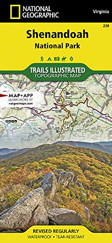
I highly recommend this National Geographic trail map. It is made of a tough materials and my experience has shown it to be accurate over the course of 20 - 30 hikes in SNP.
Enjoy your time there! Let me know if you have any more questions.
Right here.
They offer a laminated one, which I purchased initially, but had to send back because there was always a huge glare across it no matter where you viewed it from.
I think the National Geographic trail maps are far better. They're also made out of a tougher material that seems like it would be water-resistant.
I think you're over thinking it. What works for me is to have a plan going in, but if you see something cool, stop and see it while you're there. In other words, have a plan, but you don't have to stick to it.
You got a lot of good places listed. I'd add Hayden Valley to it. You'll most likely drive through it heading to different locations anyway. Just be aware that it's a parking lot in the evening. Very slow moving to get anywhere do to all the cars and buffalo on the road.
You're camera should be great. You're not going to get a good shot of a wolf or coyote unless you have a major telephoto lens. You could get lucky and see a bear close to the road...
Some hikes I'd recommend are: My Washburn (take the Dunraven pass trail, not the North trail). Avalanche Peak, Mystic Falls, and Fairy Falls are some good ones.
If you're going to do some backpacking get a topo map. I'd 2nd Heart Lake. They have an online reservation system that you could try and use. Or if you're flexible, you could just go into one of the backcountry offices (there are many) and ask the ranger whats available and what they would recommend. Most are very helpful.
As for your pass being good for 7 days, this is true. I don't think I would worry about buying another as the only time they check it is when you enter the park. There is a combo pass that will get you into YNP and GTNP, but in your case it will probably be better to buy them separate as your pass will be expired if/when you go to GTNP. It'll cost you a little more than buying the combo. Actually, if you go to GTNP from the north (which will be the best way), I don't think there's a entrance station so you could get away with not buying one, but if you go past any entrance gates you'll have to buy one to get back in (if you pass is expired). Keep in mind that the hwy through GTNP is outside of the permit area.
FYI - make sure you pack bear spray anytime your on a trail and have it ready (not in your pack). You'll want sunscreen and a hat (you burn easier at high altitudes, the avg. elevation is 8,000'). Bring bug spray. There will be bugs, but they don't get really bad until around the 3rd week of July. Always pack your rain jacket on any hike longer than a mile. I thin fleece is a good idea too. It can rain/hail/snow anytime of the year. Drink lots of water, it will help with the altitude adjustment.
There's a good swimming hole near Mammoth. It's very popular though and can get quite busy in the evenings. Head north out of Mammoth on the road to Gardiner MT. A mile or two out of town you'll come to a pullout right before a river crossing. Park here. There's an outhouse you can change in, but you'll probably have a line so it's best to have your swimsuit on already. Take the river trail back to the south following the river for less than a mile. You can't miss it.
There's another swimming hole along the firehole river drive (one way road). It's much cooler/almost cold though.
We have a wildflower guide and a copy hiking books (that I don't find that useful), but I ABSOLUTELY recommend getting the Trails Illustrated maps for the area:
https://smile.amazon.com/Brasstown-Chattooga-Chattahoochee-Geographic-Illustrated/dp/1566954673/ref=pd_sim_14_3?_encoding=UTF8&pd_rd_i=1566954673&pd_rd_r=1NG4PG5T88JR4D8D4ZNY&pd_rd_w=4WY37&pd_rd_wg=AUcqB&psc=1&refRID=1NG4PG5T88JR4D8D4ZNY&dpID=51MopJ4-QUL&preST=_SY291_BO1,204,203,200_QL40_&dpSrc=detail
I have 2 for north GA (the one I linked for for the eastern half of north GA), one for western NC, another for the Smokies, and also one for the Mount Mitchell area.
Other than good maps, I find "thru-hiking guides (AWOL AT; Bartram; Benton MacKayte; etc) to be the best collection of useful hiker info, elevation profiles, and information that is relevant for hikers.
FWIW, I have a collection of some past trips (in GA and NC) with pics, etc:
https://rmignatius.wordpress.com/adventures/
Reviews say the magnets fall off easily. Paper maps with pushpins work much better: https://www.amazon.com/Decorator-Laminated-National-Geographic-Reference/dp/0792283090/ref=pd_sbs_201_19?_encoding=UTF8&psc=1&refRID=BPQ30V68HS9ZA2EKCQ2P
I'd go for any map from National Geographic. I have this one: https://www.amazon.com/gp/aw/d/0792283090/ref=mp_s_a_1_2?ie=UTF8&qid=1466813745&sr=8-2&pi=SX200_QL40&keywords=national+geographic+world+map&dpPl=1&dpID=61p5k71NQ-L&ref=plSrch
Highly recommended. Has enough information that you can see something new every time you look at it.
Rand McNally 2019 Deluxe Motor Carriers' Road Atlas and a gas card, if you want to spend more.
This road atlas has rest areas, low clearance
inductorsindicators, and thorough details that a cross country driver will appreciate.I spent almost 7 weeks this summer on a camping road trip in the western states. A good way to get nice free spots is off of forest service roads or bureau of land management areas. I also picked up a couple of these atlases for a few states to give me better detail. Atlases are awesome because of the incredible detail they give of trails and what areas are bureau of land management.
just about any state you want ....
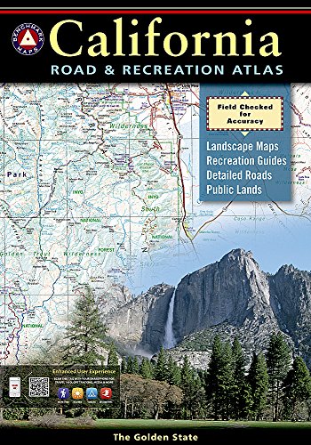
https://www.amazon.com/California-Road-Recreation-Atlas-Benchmark/dp/0929591496/ref=sr_1_45?ie=UTF8&qid=1486500907&sr=8-45&keywords=map+atlas+usa
https://www.amazon.com/California-Atlas-Gazetteer-Delorme/dp/0899333834/ref=pd_sim_14_60?_encoding=UTF8&psc=1&refRID=BZFWVQPP8M10HWEC13BK
have a mind to download or print? ....
https://drive.google.com/file/d/0B6-eYcf1HwPUUnNwTE00WXlLMkE/view
https://drive.google.com/file/d/0B6-eYcf1HwPUbUZ4WlBDNnpsc2c/view
https://drive.google.com/file/d/0B6-eYcf1HwPUZkZtX3d1aS1Ybjg/view
https://drive.google.com/file/d/0B6-eYcf1HwPUdGY0ZUtEbFY1MlpjS2JQWHU3Y0lsYWZqMHBJ/view
https://drive.google.com/file/d/0B6-eYcf1HwPUOFFSQVdhd0hiVm8/view
http://www.abandonedrails.com/
http://trains.rockycrater.org/pfmsig/atlas.php
What state are you in? Look on amazon for "atlas and gazetteer <your state>"
https://www.amazon.com/Virginia-Atlas-Gazetteer-Delorme/dp/0899333265
I just came across this post. What you want is this map: http://www.amazon.com/Benchmark-Oregon-Road-Recreation-Atlas/dp/092959150X
This has all the forest service roads in Oregon reliably marked. These are mostly gravel, and they're much more extensive than velodirt and oregonbikepacking. You can pick your own route too, which is a plus. I've spent a few months total on gravel roads, between Patagonia and winding down gravel roads on the stretch of the Cascades between Seattle and Eugene, on my Surly LHT. It's great fun. Even single track can be fun. If you're worried about it, maybe fit some knobby tires and lower the tire pressure. It is a chore sometimes, and I've now bought a Pugsley because I want to make it a bit easier on myself, but some of the most fun I've had while touring is hauling my bike over stretches of nasty gravel roads/singletrack that I didn't anticipate being as difficult as they were.
Just go look for the forest service/gravel roads in that atlas. They go everywhere, and they're often a great compromise between single track stuff and pavement.
My journeys in the NW are here. I didn't do much in Oregon because I'd been on the road for a long time and just wanted to be home, but I did a lot in Washington with a similar atlas and it was awesome.
If you're going to go east, which I cannot recommend highly enough, you will need a copy of the Benchmark Oregon Road & Recreation Atlas, which shows the back roads and campgrounds. Do not neglect this. Take Hwy 31 to Paisley, which was once a two-fisted cowboy town complete with its own whorehouse. From Paisley, use your atlas to find the gravel roads through the ZX Ranch, at 1 million acres the largest in the United States. You want to end up at U.S. 395 at Abert Rim. Hang a right and drive past Abert Lake to the town of Lakeview. At the intersection of 395 and Oregon Hwy. 140, in a red brick building that's easy to miss, you will find the Snack Shack, which serves a hamburger as good as any you will eat anywhere in the whole country.
You will now be in the Great Basin, a vast and impossibly romantic steppe (high altitude desert) that comprises most of Nevada and parts of Oregon, California, Utah, and Idaho. All rain and snow that falls there stays there, i.e. does not reach any ocean by way of tribuaries and rivers. It is probably the most remote area in the country outside of Alaska; for example, the visitor's HQ at the Hart Mtn Nat'l Antelope Refuge is farther away from an Interstate than any other spot in the Lower 48. This cattle and cowboy country; Harney County, east of Lakeview, is the ninth largest county in the U.S., and the 8th largest cattle county.
From Lakeview, there are some choices to make. The shortest route would be by way of Plush, a wide spot in the road with a cafe, through the Hart Mtn refuge. Go up to Steens Mtn., which at 9,200 feet is the tallest summit that you can drive to in Oregon and I think the entire Pacific NW. There's a loop road, and some camp grounds. It'll be on your atlas. Take it. Wind your way back to Burns and U.S. 395, then drive north. If you do that, you'll miss a lot but you will have gotten the essential landscapes. You also will have gone through the Malheur Nat'l Wildlife refuge, famous for the variety of birds. It was the first wildlife refuge in the U.S., set aside a little more than 100 years ago by Teddy Roosevelt.
The longer route would be to take Oregon 140 into Nevada (another spectacular drive) all the way to U.S. 95. Hang a left, and drive north. Look for Whitehorse Ranch Rd. and hang a left. Well-maintained gravel road that ends at Oregon Hwy. 205. You can stay on that all the way to Frenchglen, or to that Steen's Loop Road that I mentioned. Find your way to Oregon Hwy. 78 and rejoin U.S. 95. Look for Leslie Gulch Rd., which takes you through spectacular landscapes to the Owyhee reservoir. RV sites. Go back out and drive to Ontario (a true dump of a town) and find U.S. 20.
Take U.S. 20 through more spectacular landscapes to Burns. Hang a right on U.S. 395 and find the town of Seneca. Take Forest Service Rd. 16 to Hwy. 62 and back to Prairie City. Hang a right on U.S. 26, making sure to stop at the top of the hill for a killer view of the Strawberry Mountains that you drove around on 16 and 62. Hang a left at Oregon Hwy. 7 and drive to Baker City, arguably the nicest little town in Eastern Oregon, and with some surprisingly good food.
At Baker City, get on I-84 toward Portland. But do not pass up the Oregon Trail Interpretive Center about 5 miles out. It's definitely worth the two hours. Tells the whole story of the largest mass migration in modern North American history.
You can do the short way in a few days, and the long way in about a week or so. I cannot recommend the long way highly enough, but if the high desert ain't your cup of tea then do the shorter way and take 395 all the way to Pendleton and I-84. Either way, you'll have driven through a region chock full of Western history, which I can talk about if you want. You'll be way out there in the Great Nowhere, but not beyond help if you need it. If you're carrying a cellphone, Verizon's the carrier to have out there. By far the best coverage. But do NOT rely on it and Google maps and/or your vehicle's nav system to the exclusion of that atlas I recommended.
The roads I've mentioned are very good, but don't be foolishly unprepared. Make sure to have good tires and to know how to change one. Carry more water than you think you will need, and keep an eye on the gas gauge because the stations are few and far between. And this is not sandals and shorts country. There are plenty of rattlesnakes out there, so a pair of suede cowboy boots and long pants are essentials. And have a hat and sunglasses and sun screen. Watch where you walk, especially at the Owyhee reservoir.
I haven't listed all the places, but I've hit the highlights. It's a truly spectacular region of America, not well traveled because it's so far away. That's actually the saving grace. There are places out there that, except for the roads, are otherwise unchanged in >100 years. And you'll have a lot of it mostly to yourselves, with the exception of a pickup truck every now and again.
My favorite State maps are by Benchmark. They make really nice large format road atlases that have a fantastic level of detail in terms of features and tiny local roads (even logging roads where I am in PNW). They are easily findable on Amazon.
https://www.benchmarkmaps.com/
https://www.amazon.com/Oregon-Benchmark-Road-Recreation-Atlas/dp/0929591607/
I would pick up natgeo map 229 check out the east side around Cosby Park. I was there for a day hike in the middle of summer and there were not many people there and plenty of parking so it would be a good place to leave a car and there are plenty of trails and campgrounds around to make a lot of good loops. There are lot's of nice waterfalls and such to check out in the area. If you want some loop suggestions I can look at my map and come up with some. Clingman's Dome is a nice area but when I was there last, there was no parking and even if I could find one I would feel guilty taking up a space for several days. I'm not sure about this time of year.
I buy the National Geographic maps. I carry that, and an atlas whenever I go out. I don't have a GPS yet, and even if I did, I still would have these.
Bought the physical map on Amazon and scanned it. Great Smoky Mountains National Park (National Geographic Trails Illustrated Map) https://www.amazon.com/dp/1566953014/ref=cm_sw_r_cp_apa_sBYKyb1ABXKWY
I overmapped when I did it over 2 trips 4 and 5 years ago lol. I brought the Nat Geo map and the Adirondack Paddler's Guide. Obviously I wasn't paddling but that one shows all the campsites while the Nat Geo map only shows lean-tos.
Also note that the new sections of trail on both ends where it connects to Route 3 are not on either map since those sections were just recently completed to cut off a bunch of the road walk.
I would suggest bringing the Nat Geo map for mileages and such and a paper print out of the one on the CL-50 site since it shows campsites and the new sections.
I took a class in undergrad about languages of the world. One of the textbooks we used was The Atlas of Languages. It had a lot of helpful overview information and the class was open to non-majors so the book was pretty easy to understand.
I couldn't find the newer version (it was updated in 2008), but amazon has an older edition for less than $15:
Here!
The CL50 map that the website usually links to was updated last week, and I don't know if they actually got the update posted online. There's always the NatGeo map that has a realy nice look and feel.
If you're into Facebook, there is a Cranberry Lake 50 group that can answer a lot of your questions.
go for it! I used this map; it's 24"x36" but they have larger sizes too. And if you're only interested in Europe, they have a Europe specific map. I would watch a few videos about modge podge if you haven't done it before because it can get messy, especially when dealing with larger prints. Also, make sure your cork board isn't too thick for the frame; I think I used 1/4" thick cork board. This was the original inspiration for my map
For some reason, Im drawn to these black trees for some sort of decoration, depending on how tall they are, they could be centerpieces maybe?
I like this wristband bracelet for bridesmaids to wear, if you have some, or even yourself, depending on your dress color.
I like the idea of black candelabras everywhere, I feel like they are very romantic/dark, if done right. Something like this minus the fake spiders, and these Bleeding candle sticks are very cool.
If you're serving punch, an intricate black punch bowl would look great. Maybe a bowl on every other table, since they're little?
Satin flower girl basket, but I think there is a whole set for this, with a guest book and ring pillow. The gems are white, but it looks like you could easily pop them out, and place them with purple.
Instead of having guests sign a guest book, you could frame this Map of Europe and take the glass out and have people sign it. It would look amazing with all the well wishes on it, but still have a neat background to it.
A set of these Apothocary jars, filled with candy or matches, placed at the bar, or around the cake table, just as little accents. And you could wrap them with a band of purple ribbon to help tie your colors together.
And lastly, I always love candles at a wedding I feel like they are the symbol of romance. Lots of candles, everywhere. They give off just the right amount of light.
Good luck, hope Ive helped just a little. <3
Thanks for the contest! I hope to see pics of how the wedding decorations look!!!
This is an awesome thing to look at if you're baked. Excuse me for assuming you smoke bud; hookahs smokers usually get down with that.
So here is my slightly OCD google map with various layers. I went in early September and the weather was mixed, lots of rain and lots of wind (more on that later). We rented a small campers van, and did 10 days on the road, as shown in the Directions layer, not including the few days we spent in Reykjavik on the front and end of the trip.
https://drive.google.com/open?id=1K5W6zzTjajCxAjvD_g44H2PIDb4&amp;usp=sharing
Some comments:
Itinerary: Personally I think you might be biting off a bit much, I would suggest trimming somewhere so that you can enjoy the days a little and not just spend your time driving. Getting inland is no joke, the roads are extremely precarious. There are even patches of the ring road and some of the main roads off of it that are close to what I would consider off-road level. I would suggest trimming the West Fjords as we did, and DEF opt for the the Snæfellsnes peninsula, you can do it like a loop.
Camping: We saw a lot of tent campers, and I for the most part did not envy them. the pro: most campgrounds have a common space thats heated with kitchens and places for you to escape the weather. The con: the weather, there were some nice tent camping days but as you go north it can get very cold and the weather was a lot less cooperative.
Roads: I would reallllly suggest that you avoid the F roads, the rental companies do not mince words with how treacherous they can be, once you see the type of vehicles they use for the inland tours you will understand. I would focus on doing as close to the full ring road or at least the primary roads, you will not be robbed of absolutely jaw dropping scenery at every turn. Once you get outside of the golden circle, you'll practically have the road to yourself for hours upon hours at a time. Also: I cant recommend getting a quality waterproof road map. https://www.amazon.com/Iceland-National-Geographic-Adventure-Map/dp/1566955343
Any other questions, I am happy to help! I sunk hours and hours into researching and planning our trip, so glad to get mileage out of it for someone else.
The other posts here cover most of the general info but I do want to add two small but important points:
Well, like I say, the first thing would be to be flexible. Try not to make definite plans. You really could get here and the weather will be fine. Or it could be a complete shitstorm throughout the state. It could be soaking wet at the coast and snowing in the Cascades. So all I can do is tell you my favorite spots in the state, and you'll have to check when you get here and see
One thing to do is get an Oregon atlas.
http://www.amazon.com/Benchmark-Oregon-Road-Recreation-Atlas/dp/092959150X
This is not just a detailed map (which you will need if you go into the back countrty), but also lists a lot of campgrounds. Unfortunately, you have a government shutdown that might continue, so you might not be able to get Forest Service maps at the BLM offices around the state. If they're open by the time you get here, you should do that too.
With that, here are my favorites:
"It's a terrible time of year to go camping, but you never know," said my other half, when I mentioned this thread. Note that a "primitive campground" has no facilities of any kind. Pack it in, pack it out. Bury your poop.
Once again, Google the campgrounds with yurts and cabins. The state of Oregon has a good website that lists state parks and campgrounds. Finally, don't be the sort of dummy who goes out to these places without equipment, supplies, or common sense. Sorry to keep saying that, but it happens all the time out here and people get sick of it.
I think I will end up doing something similar. I am looking at getting the National Geographic Trails Illustrated maps for the regions I like to backpack in. They are waterproof and tear resistant and supposedly have great detail. Do you have any experience with them?
we purchased the National Geographic Adventure Travel Map from Amazon
It is nice that its a heavy duty, water resistant map. It seems to be pretty accurate and robust. Main only complaint is that it splits the island in half... one half per side. There is a few inches overlap on each side, but it was somewhat annoying to not see the whole map at once during the travel planning phase.
*Edit - Sorry, I just read your post again and realized I missed something key. I don't know how accurate it is for going far off of the Ring Road.
I've never rented an RV, mainly because of the cost. It seems to be more expensive than staying in hotels. The rental RVs you see most often are from Cruise America.
For Zion, there's 2 must see hikes. The first is Angel's landing. It's a relatively short hike (~5 miles) that will take 3-4 hours. The views are great, but the most impressive part is the trail, which is a true masterpiece in trail cutting. The second is the Narrows. The Narrows is often cited as the best hike in America, which I can not argue with. The Narrows is a thin canyon that is as wide as the river which you can hike ~16 miles up. You can do it as an in and out from the bottom or a through hike from the top. If you do it from the top you will need to get a shuttle and it takes ALL day. Ive done it both ways and from the top is the best way to go if you have the time and stamina. Ive rented equipment (which you will want the special shoes either way) and got a shuttle from Zion Outfitters. If you decide to do the through hike from the top you will need a backcountry permit. Try to reserve it ahead of time, but I did the last minute drawing without a problem. The East Rim and West Rim trails provide more typical hiking. I have not done the West Rim and it needs an overnight. The East Rim trail was great. We hitchhiked from the visitors center to the trail head without any problem (people are friendly in NPs) and then took a shuttle back to our car. National Geographic makes a great trail map if you want to see all the trails. In terms of lodging, there's two campgrounds in the park, lots of hotels in the town of Springdale right outside the park, a lodge in the middle of the park which always seems to be booked, and some BLM land a little to the south.
After Zion, Id go to Bryce Canyon for the morning (early) and do the Fairyland loop (~9 miles, mostly flatish) and check out some of the trails near sunset point. There's a shuttle so you don't need to hike back to your vehicle if you don't want. After a nice morning in Bryce, you'll want to drive east along route 12 (not how google takes you) towards Moab. Route 12 is straight out of a road runner cartoon. Along the way there's 3 places worth stopping that Ive found in order of awesomeness: Goblin Valley, Calf Creek Canyon, and Capital Reef. YOu may want to do the drive from Zion to Moab in 2 days depending on your schedule.
Once in Moab your choices for hiking are endless. Moab has lots of hotels, arches and canyonlands have campgrounds, and there's some awesome BLM sites along the Colorado river along route 128 just north of town. The 2 must hikes are Devil's garden loop in Arches and The Needles in Canyonlands. At some point you need to catch the view from Dead Horse Point or Island in the Sky but there's not much hiking there. If you have the time and resources, Id suggest doing some of the "adventure" activities from the outfitters in Moab. There's white water rafting, fan boat rides, canyoneering, and many other options. Ive always wanted to rent a 4 wheel drive high clearance vehicle and tour the Grand Staircase Escalante (which is being turned over to oil companies thanks to our dear leader).
In terms of timing, it seems like May 15th is a critical date. That is when the north rim of the grand canyon reopens after the winter. How does that line up with your schedule?
After you're done with Moab, you're about equidistant from Las Vegas, Denver, Albuquerque and Salt Lake City airports. If you're heading back to Vegas, Id go through Page AZ and hit The Wave (you need a permit) and north rim of the Grand Canyon. If you're heading to Albuquerque, Id spend a night at the Orvis Hot Springs and do a little hike in Ouray CO before heading to Chaco Culture. If you're heading to Denver, there's a million options along highway 70. If you're heading to SLC, it's mostly salt flats and indian reservations until you get close to Provo but there's lots to do near the metropolitian areas.
Hope that helps, let me know if you have any questions or want more details and please let me know how the trip goes!
If you don't have one of these I highly recommend it.
Also If you don't have much luck here, ask around in the LBS's and touring companies in Moab.
Thanks for the suggestions everyone. After some more googling, this looks like a good option. Too bulky for a handlebar bag, but I could photocopy the pages I need (old school).
http://www.amazon.com/California-Road-Recreation-Atlas-Benchmark/dp/0929591496/ref=pd_bxgy_b_text_y
I was persuaded by this negative review:
> I've enjoyed the Benchmark atlases for years [...] but don't care for the new one. [...] Benchmark has now included so much detail -- every tiny stream, for example -- that it's hard to read.
Bingo! Anybody used this series?
Late to this dance but I have two cents. The Madison is long, and the type of camping might help make suggestions. As mentioned Ennis or W. Yellowstone may be your bases of operation (groceries and what not). I personally recommend the Madison between Hebgen Lake and Ennis Lake. That is a long stretch of water with some super productive fishing lately, although it has been getting warmer and the fishing is getting slower in the afternoon. Below the damn on Hebgen all the way to Quake lake is quality there is a couple camp grounds right there near Beaver ck. Below Quake lake toward Ennis at Gold Butte there is a campground and again at Ruby Ck. these mentioned are all quality fishing accesses with camping facilities. There are many many more as you work down the maddy, most of the fishing access are at or near a campground. I would start high (Hebgen) and work your way down stream to Ennis camping at multiple spots. Buy a http://www.amazon.com/dp/0899333397/?tag=googhydr-20&amp;hvadid=12503023067&amp;hvpos=1t1&amp;hvexid=&amp;hvnetw=g&amp;hvrand=973034872824961472&amp;hvpone=17.05&amp;hvptwo=&amp;hvqmt=b&amp;hvdev=c&amp;ref=pd_sl_1it1skj9ql_b
This is a handy map reference that will steer you around and let you leave the beaten path with some confidence. Hint: checkout Wade and Cliff lake right in the area I suggested. Happy hunting.
First, don't use the freecampsites website. It will take you place people already are at and many which have "become a problem" and are now illegal. I've checked some of the places I've had unexpected run ins with cops. Many are listed as great spots on that site.
Read this and go explore:
https://www.fs.usda.gov/detailfull/fishlake/recreation/?cid=stelprdb5121831
The best place to camp is the one you found yourself. The West is full of an unbelievable amount of public lands.
I strongly recommend maps. These:
https://www.amazon.com/gp/product/0929591208/ref=ox_sc_act_title_1?smid=ATVPDKIKX0DER&amp;psc=1
Or these:
https://www.amazon.com/Montana-Atlas-Gazetteer-Delorme/dp/0899333397/ref=pd_sim_14_11?_encoding=UTF8&amp;psc=1&amp;refRID=RE0TC48TPVXWDQ1QPFC4
I think I prefer the Delorme.
Hard copy maps in this day and age! Land ownership from public to private doesn't change often. These maps lay out land ownership much better than digital sources I have used.
I realize this isn't the book you're looking for, but you might find the Atlas of Languages interesting as well.
This diagram is better, and by NatGeo. I have it hanging on my office wall:
http://www.amazon.com/Universe-Tubed-National-Geographic-Reference/dp/079228092X/ref=sr_1_3?ie=UTF8&amp;qid=1421380141&amp;sr=8-3&amp;keywords=galaxy+map
LUCKY 13
This:http://www.amazon.com/The-Universe-Wall-tubed-Reference/dp/079228092X/ref=wl_it_dp_o_pd_S_nC?ie=UTF8&amp;colid=29EV0QB26LQYK&amp;coliid=IW3H4YECJ2NTH
And it's on my wishlist!
It will help me out when I take astrophysics in the fall!
There's a 1997 version on Amazon, but just searching around makes me think that this is a better choice as far as time lines go.
Better crack out your checkbook. If you can find one, it doesn't look cheap.
http://www.amazon.com/Rand-McNally-Histomap-World-History/dp/052884363X/ref=tmm_other_meta_binding_title_0
Buy one of these. The spiral bound is much better.
I spent 8 years in the medical field. I feel your pain. Be prepared to work 60 hours per week, schedule will not be reliable.
We took long drives growing up too. Half of my dad's family lives in southern California and Arizona. Whenever we visited, we would pull an all night drive down from southern Oregon. There's something magical about waking up in Laughlin, NV at 8am to your dad blasting "Welcome to the Jungle" to wake everyone up and then asking which casino we should stop at to hit the buffet and blackjack tables. (Plenty of other great trips and stories all over the West too. But that one captures the unplanned, unconventional nature with which we travel pretty well.)
Is the book you received like this? I love those things. I found it really useful to have on when I lived on the east coast. Because there is so little public land compared to here, it was hard for me to find good places to explore without those maps. (And out here, I need them so I don't go and get us lost and killed up in the mountains on BLM roads).